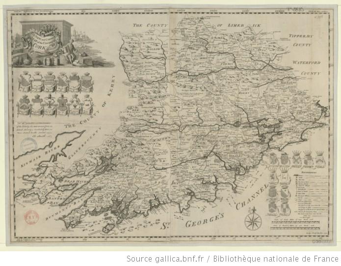
A new and correct map of the County of Cork 1750, Smith.

Tags

, ,


A New and Correct Map of the County of Cork : To the Nobility and Gentlemen of this County / this Map drawn from an Actual Survey is inscribed by their most obedient humble servent, Ch. Smith ; Ridge Sculp.t

Date: 1750
Geographic coverage: Irlande
Type: cartographic resource |    document cartographique |    map |    carte |   image fixe |    image |    still image |
Relation: Appartient à : Collection d’Anville ; 02685 B   Notice du catalogue : http://catalogue.bnf.fr/ark:/12148/cb406082856/description
Description: Échelle(s) : [1:250 000 environ], Scale of Irish Miles of 2240 Yards each 10 [= 10,1 cm]

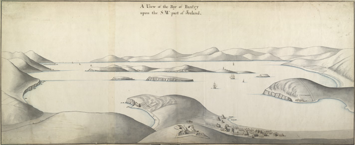
A view of the Bay of Bantry c. 1700, British Library.

Tags

, ,


A View of the Bay of Bantry upon the S.W. part of Ireland 38.b

Creator:

Artist : Unknown

|

Date: [1700]   c.1700

Geographic coverage: -9.700000, 51.633331

Bantry Bay

Type: StillImage |    Topographical Drawing |

Subject: Bantry Bay, Cork, ireland |    George III, 1760-1820 — Art collections |   710 |

Relation: King George III Topographical Collection. Collect Britain

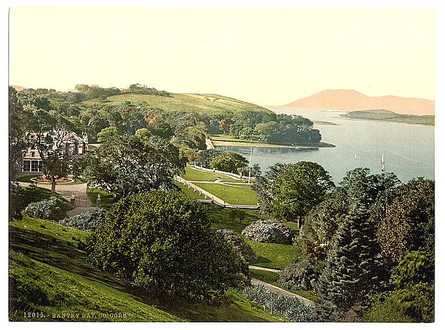
Description: View of Bantry Bay in Ireland. Richard Pococke (1704-1765) an Irish traveller, wrote the following words about Bantry Bay, when he journey there in 1758, ‘The bay as far as we could see it, lock’d in by the land, appear’d like a long lake, with beautiful Islands in it, fine small bays which they call coves and well cultivated heads of land making into it, and within them, small hills under corn, and all bounded by very high rocky mountains, at a proper distance, altogether making the most pleasing and with that the most awful sight that can be imagined. At the bottom of the South east Cove of this bay of Bantre, the town of Bantre is situated, which tho’ small is the best on the coast to the west of Kingsale.’

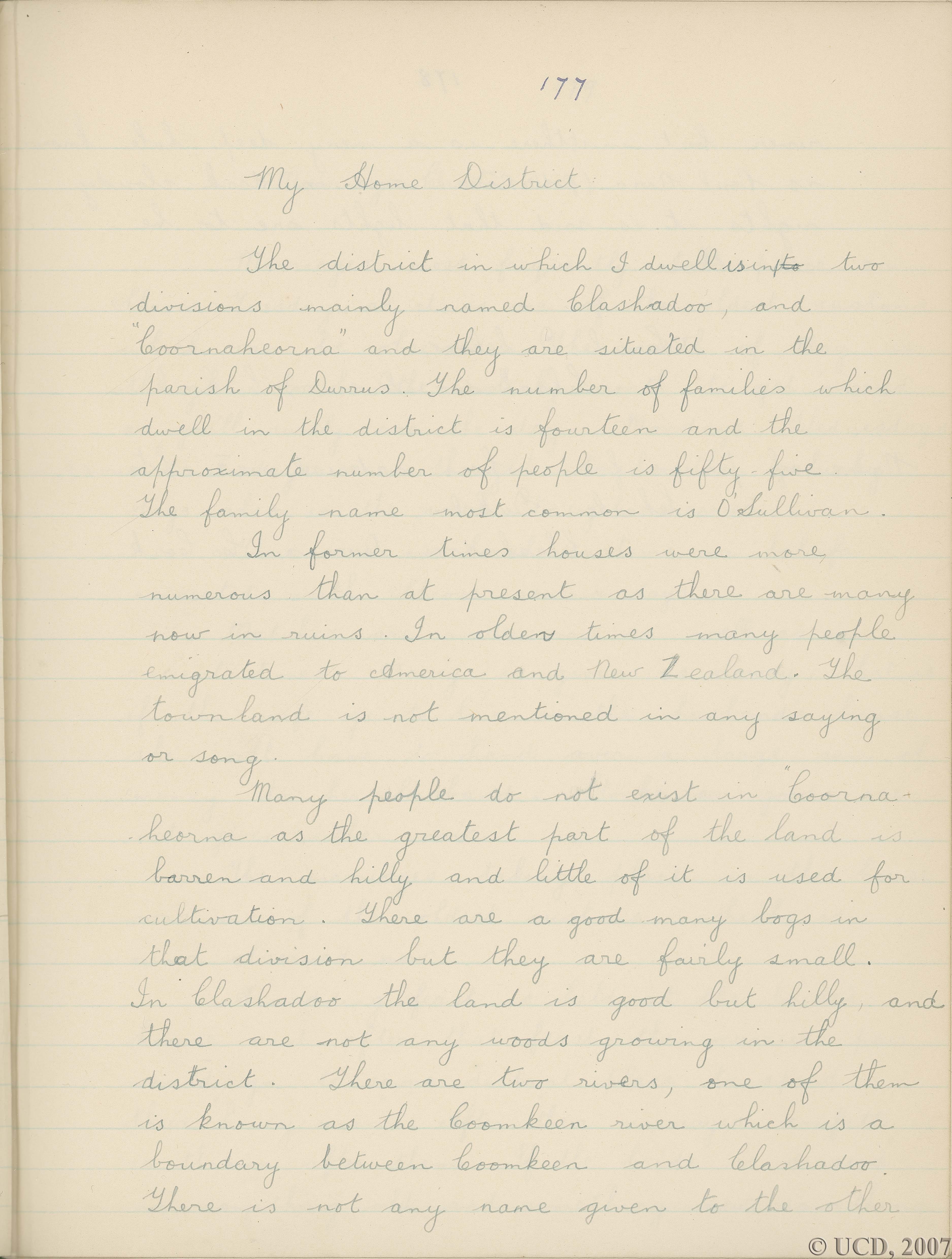
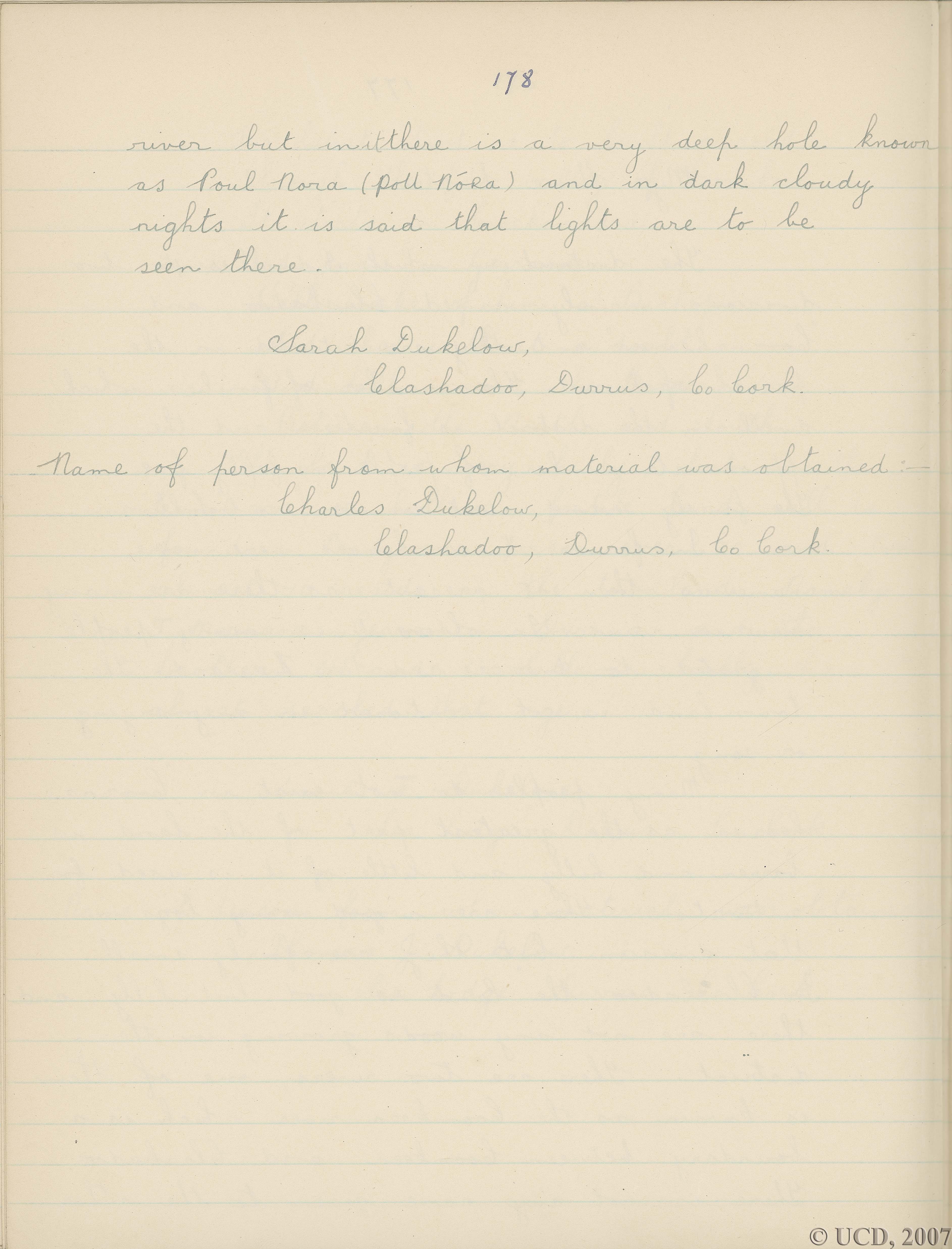
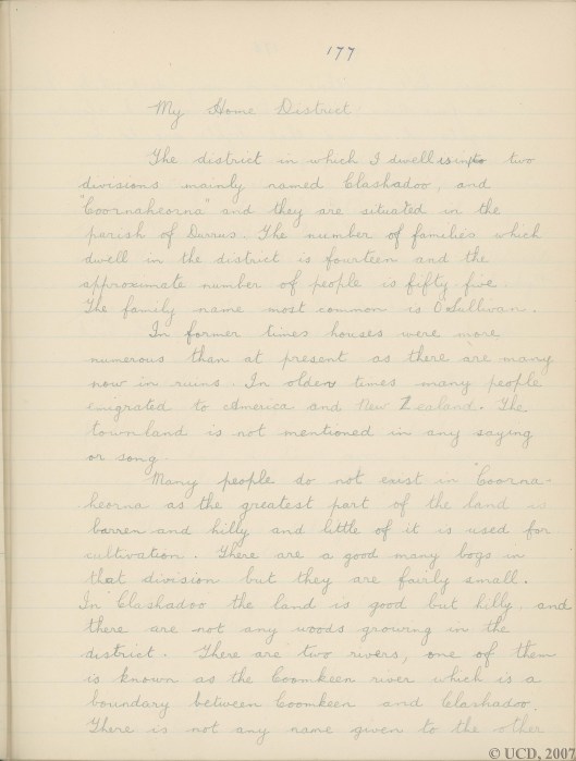
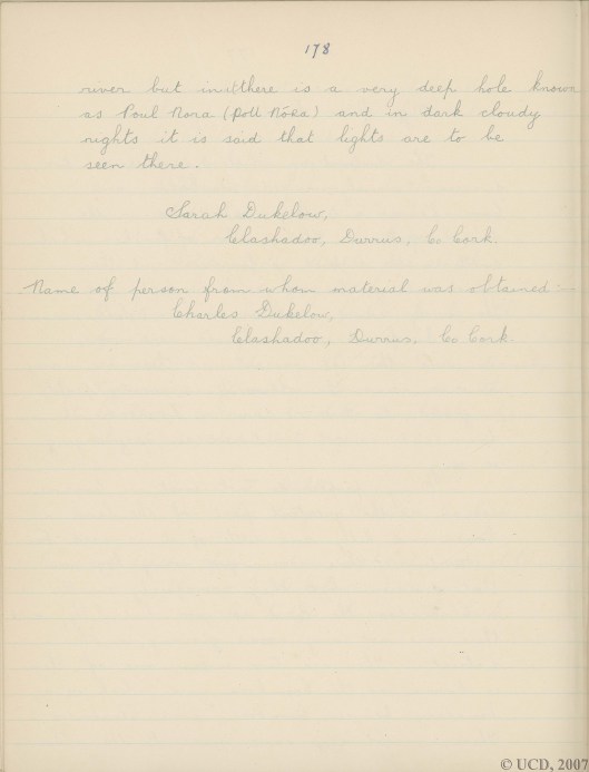
1938 School Folklore Project, Sarah Dukelow, Clashadoo, Durrus, Co. Cork.

Tags

, ,


https://www.google.ie/maps/place/Clashadoo,+Co.+Cork/@51.6319007,-9.5460531,12z/data=!4m2!3m1!1s0x48459fd56e65e3f7:0xd76f2e9f91b569c0

Sarah Dukelow is still alive, formerly a National Teacher, July 2016. The teacher in her school, St. James, Durrus, Líam Blennerhassett, from Tralee was particularly inspiring. Part of the collection has now gone online the rest in phases will happen. The collection is the most extensive in the world.  It was saved from possible destruction in the 1960s by TK Whitaker who ordered it be placed in the new UCD campus from the dangerous store at Stephen’s Green.

She said that two of her informants were Jack Dukelow and Mick Bohane the parish Priest’s manservant.  Her father used to have ‘scoraoichts’ in his house at Sea Lodge. Some distance away on Sundays there used to be a pattern for local dances in the afternoon.

From Mick she got a poem in Irish which she transcribed. He did not speak Irish but this was by his grandmother in the style of the lament composed by Eibhlín Ni Chonaill on the death of her husband, ‘Caoineadh Art Ó Laoighre’. She wrote it in the jotter supplied but the teacher did not send all the jotters to Dublin. She said that went to Dublin was only a fraction of what she collected.

Jack Dukelow died in around 1954 and was from Rossmore, grandfather of the present Eric Dukelow. On his mother’s side he was Sullivan one of the Hurrigs who claim descent from O’Sullivan Bere. He told her that during the Famine boats from America used to come with meal to the pier near her house at Gearhameen. On one occasion the meal landed it the man in charge called out names from a list. On man from Kilcrohane was in a terrible condition but as his name was not on the list he got nothing. Jacks usual greeting to people was ‘T’anam an diabhal.

https://docs.google.com/document/d/1Gnw2LsIbV0Wxk2bGjzCPq9sH9rCCQOrYTh5c0bG7vf0/edit

She mentioned that in the long hot summer of 1940 Tuna arrived in Dumnanus Bay and the pilchards returned. Her father used to cure them on slabs on the pier in front of their house at Sea Lodge, Gearhameen..
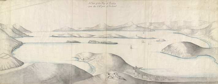
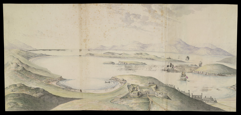
View of Bantry Bay c 1725, British Library.

Tags

, , ,


A View of the Bay of Bantry

Creator:

Artist : Unknown

|

Date: [1725]   c.1700-1750
Geographic coverage: -9.700000, 51.633331
Bantry Bay
Type: StillImage |    Topographical Drawing |
Relation: King George III Topographical Collection. Collect Britain
Description: View of Bantry Bay in West Cork, Ireland. It is the largest bay in south west Ireland and stretches almost thirty miles from the town situated on its banks, to its entrance and the ocean. The Beara Caha mountains surround the bay. The bay has twice been the site of foreign invasions, by the Spanish in 1689 to support James II and by the French in 1796 to support an Irish uprising.

See more

Data provider: The British Library |
Provider: The European Library |    UK |

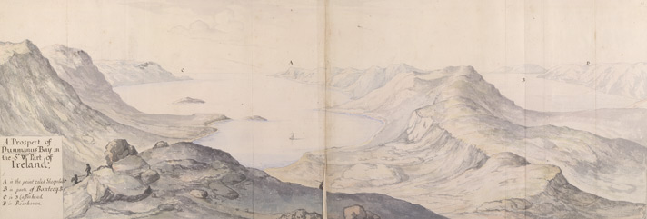
Prospect of Dunmanus Bay c.1720, British Library.

Tags

, ,


A Prospect of Dunmanus Bay in the SW part of Ireland | Artist : Unknown

View item at

The British Library

Rights: Copyright © British Library Board
Identifier:003KTOP00000052U04100000  Ktop LII
Format: Watercolour   jpeg

A Prospect of Dunmanus Bay in the SW part of Ireland

Creator:

Artist : Unknown

|

Date: [1720]   c.1720
Geographic coverage: -9.666667, 51.533333
Dunmanus
Type: StillImage |    Topographical Drawing |
Relation: King George III Topographical Collection. Collect Britain
Description: View of Dunmanus Bay in County Cork, Ireland in c.1720. Dunmanus Bay lies between Mizen Head to the south and Bantry Bay to the north and now the village of Durrus sits at the head of the bay. Sheep’s Head peninsular, which is identified on this view, is even now an area of outstanding natural beauty.
Data provider: The British Library |
Provider: The European Library |    UK |

Explore further!