Francis Jobson’s Map of West Cork, 1589 including Cape Clear (Iniskyran), Baltimore, O’Driscolls, Rosbrin, Crookhaven, Bantry, Muintervara land of Rymers (O’Daly’s Bardic School), O’Sullivan Bere, Priest’s Leap.
From Dr. Elizabeth Fitzpatrick on the Bardic School.
Map of Co.Cork and Kerry, 1575.
1588 Map of Beare and Bantry from Public Record Office, London, showing Soldiers besieging Castle, Deer in Glangariff, Churches, castles, Houses, Ships, with Commentary, 1958, by Bantry Antiquarian Paddy O’Keeffe.
John Speed, Map of West Cork, 1630.
Map of Carbery West Cork in Tudor Times.
Early Map of Baltimore, West Cork (Between 1605-1640), showing English Settlement, Dunasead Castle, Sherkin Island, Loo Rocks, Storehouse for Preserved Fish, 12 Fishing Boats, Seine Pilchards, 5 Possible Royal Navy Boats.


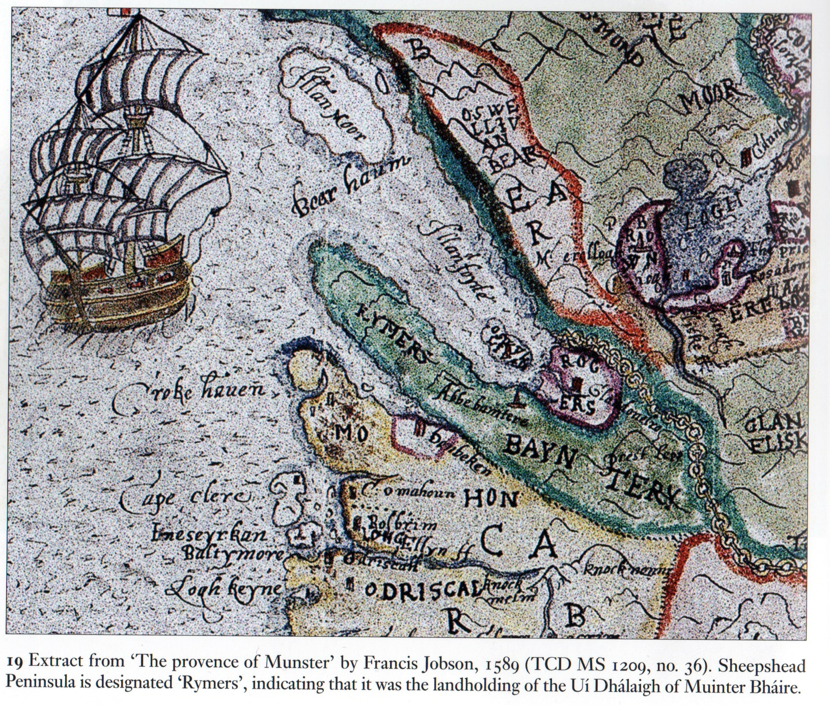

And there’s Rossbrin!
LikeLike
Pingback: 1905 Valuer’s Report on Estate of Lord (Charles Pelham) Clinton, Crookhaven, West Cork 1905, Crookhaven formerly flourishing, Pilot Station, Fishing even the Isle of Man Fleet now gone, all now passed, Evidence of Want Of Circulation of Money, Coppe
Pingback: Memorial to The O’Dalys of Muintiravara, For Many Centuries Prior to 1600 Sub-Chiefs to the McCarthy Mór and The Desmonds, Active in The Munster Wars For Religious And National Freedom. They Suffered Confiscation, Exile and Local Extinction. | West
Pingback: 1788, Bantry, Some Pilchards Taken. Hopes of Return of Shoals Dashed. 1791 Map Co. Cork River Systems. | West Cork History
Reblogged this on West Cork History.
LikeLike