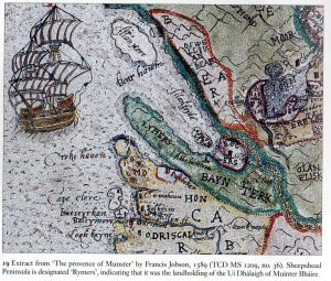
Francis Jobson’s Map of West Cork, 1589 including Cape Clear (Iniskyran), Baltimore, O’Driscolls, Rosbrin, Crookhaven, Bantry, Muintervara land of Rymers (O’Daly’s Bardic School), O’Sullivan Bere, Priest’s Leap.
From Dr. Elizabeth Fitzpatrick on the Bardic School.
Map of Co.Cork and Kerry, 1575.
1588 Map of Beare and Bantry from Public Record Office, London, showing Soldiers besieging Castle, Deer in Glangariff, Churches, castles, Houses, Ships, with Commentary, 1958, by Bantry Antiquarian Paddy O’Keeffe.
John Speed, Map of West Cork, 1630.
Map of Carbery West Cork in Tudor Times.
Early Map of Baltimore, West Cork (Between 1605-1640), showing English Settlement, Dunasead Castle, Sherkin Island, Loo Rocks, Storehouse for Preserved Fish, 12 Fishing Boats, Seine Pilchards, 5 Possible Royal Navy Boats.