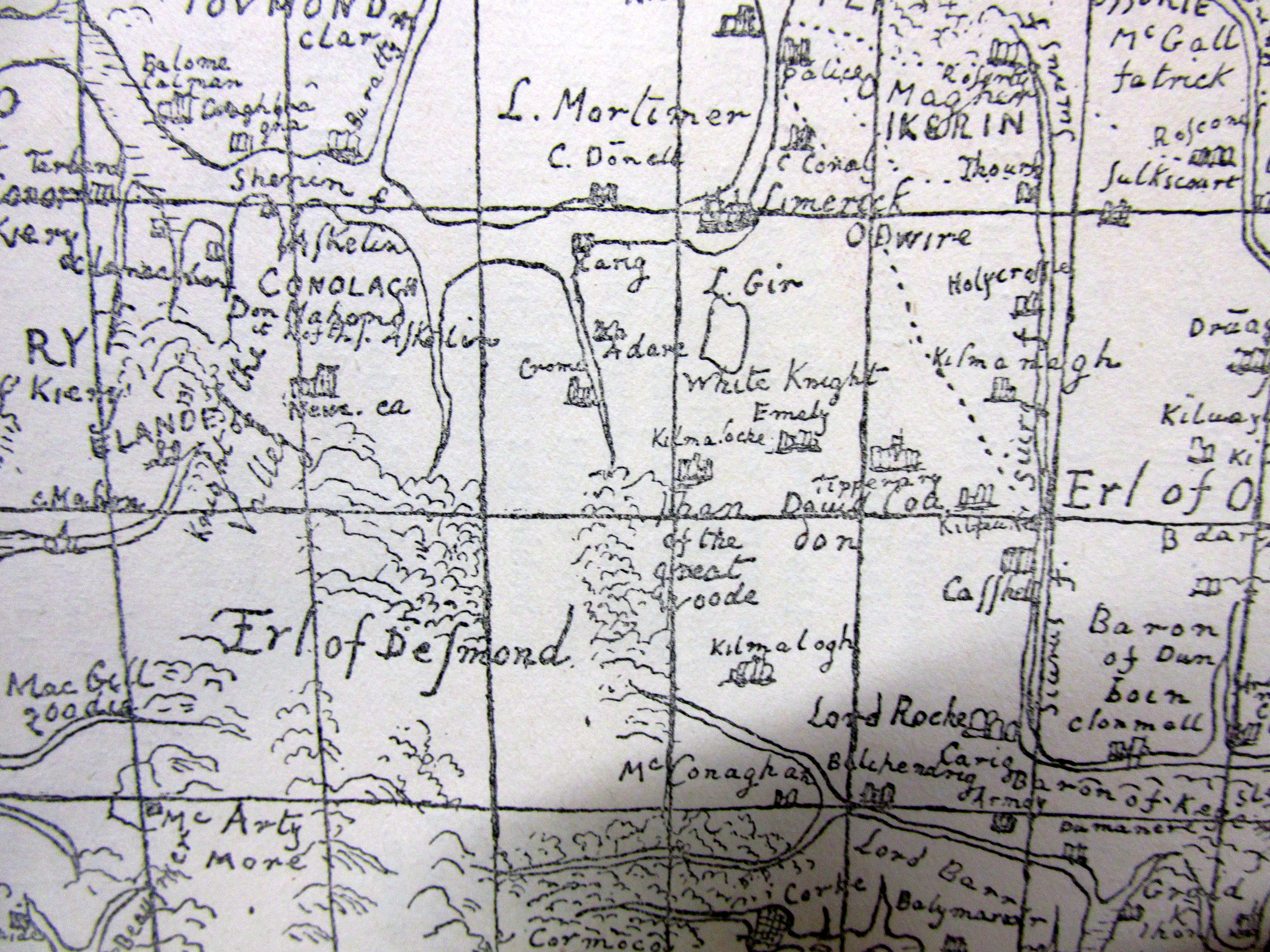
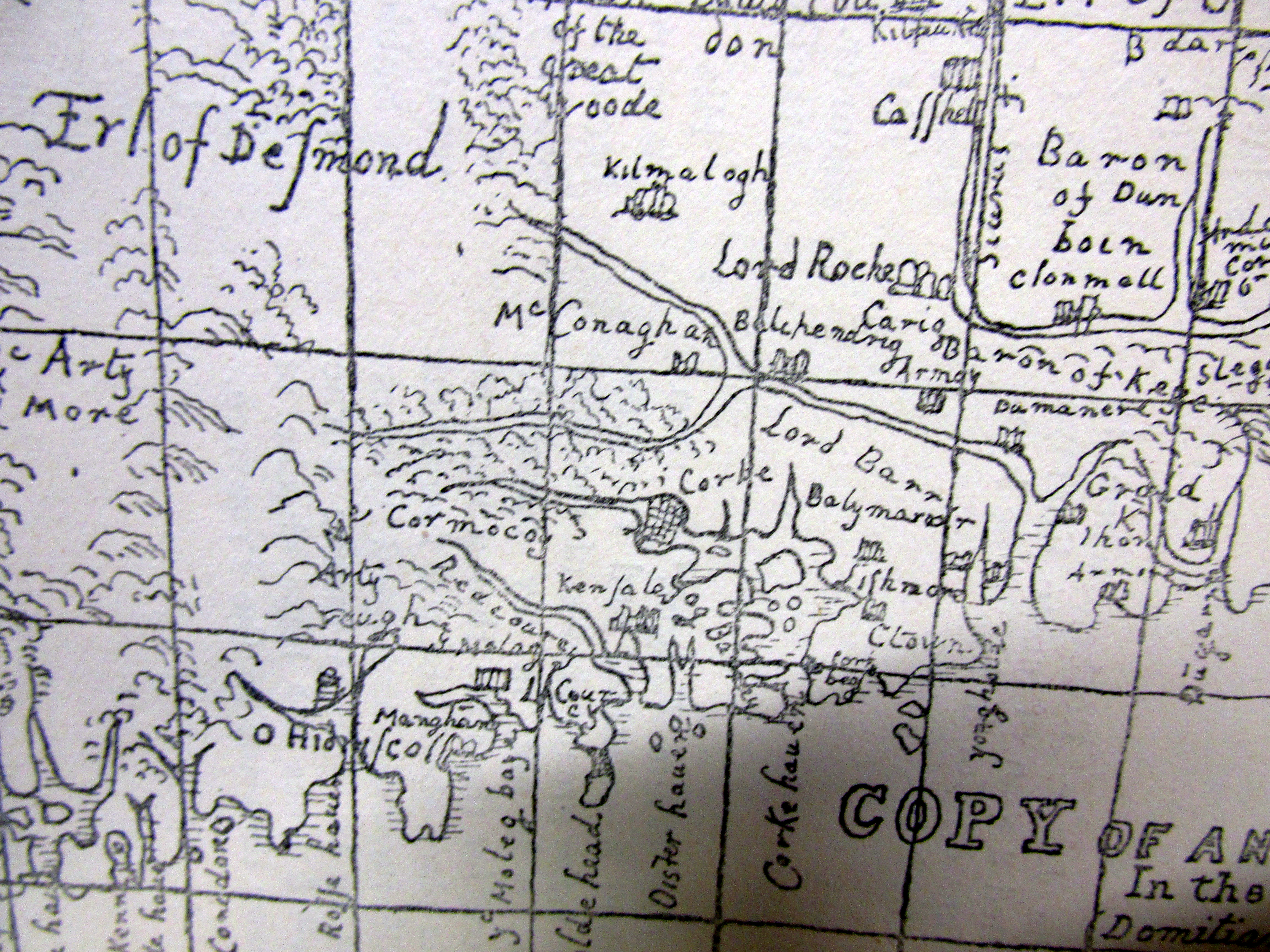
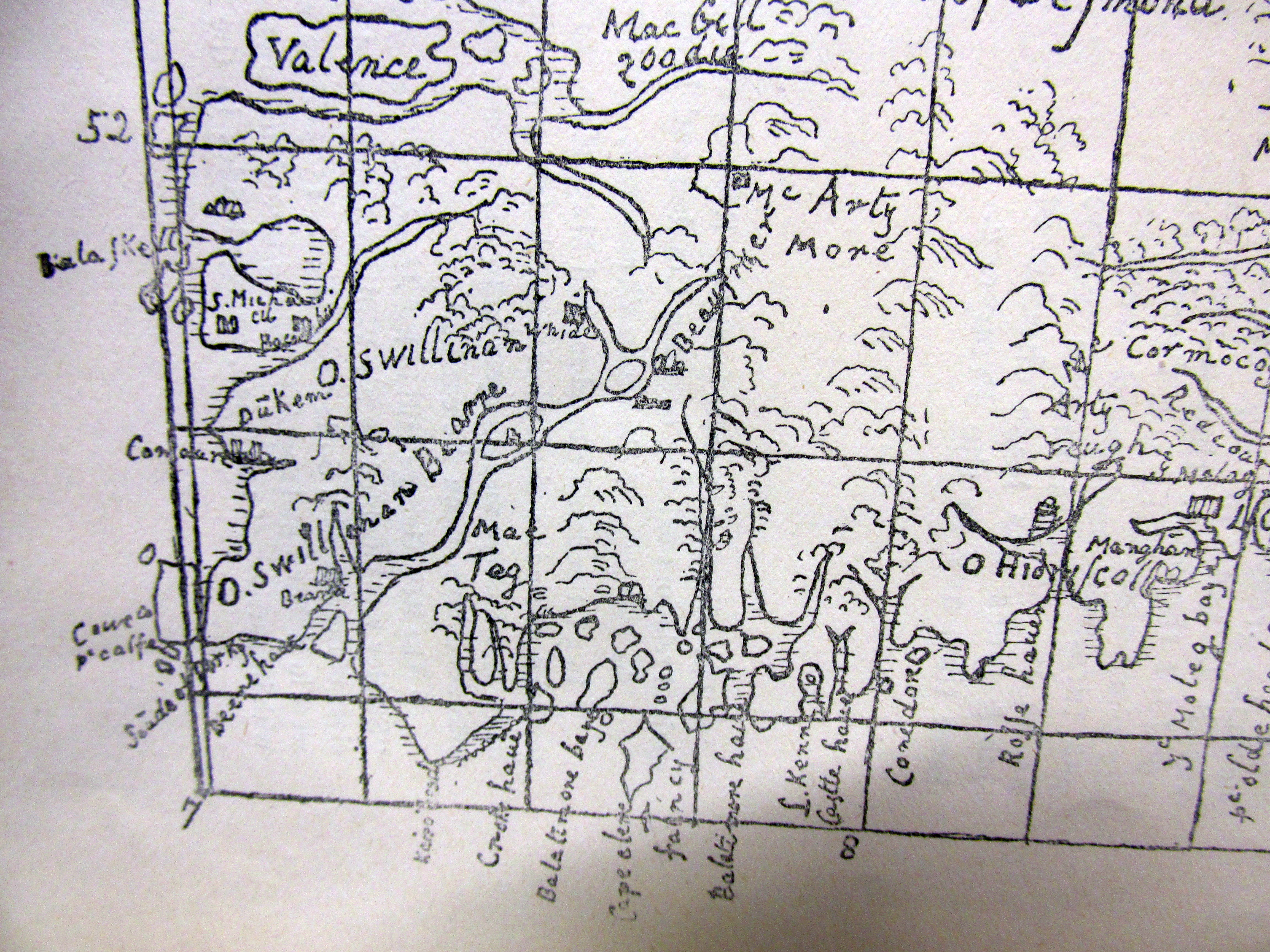
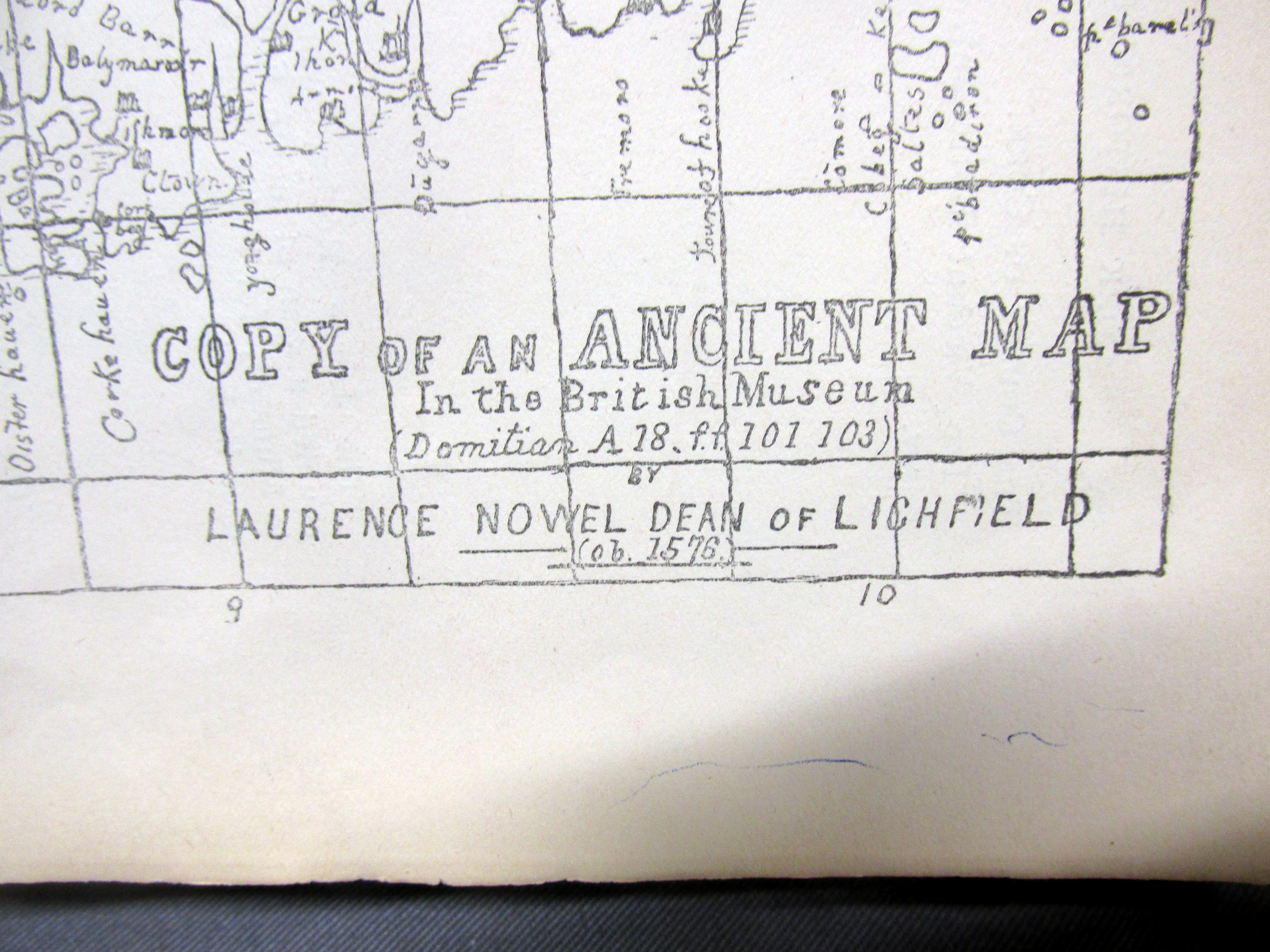
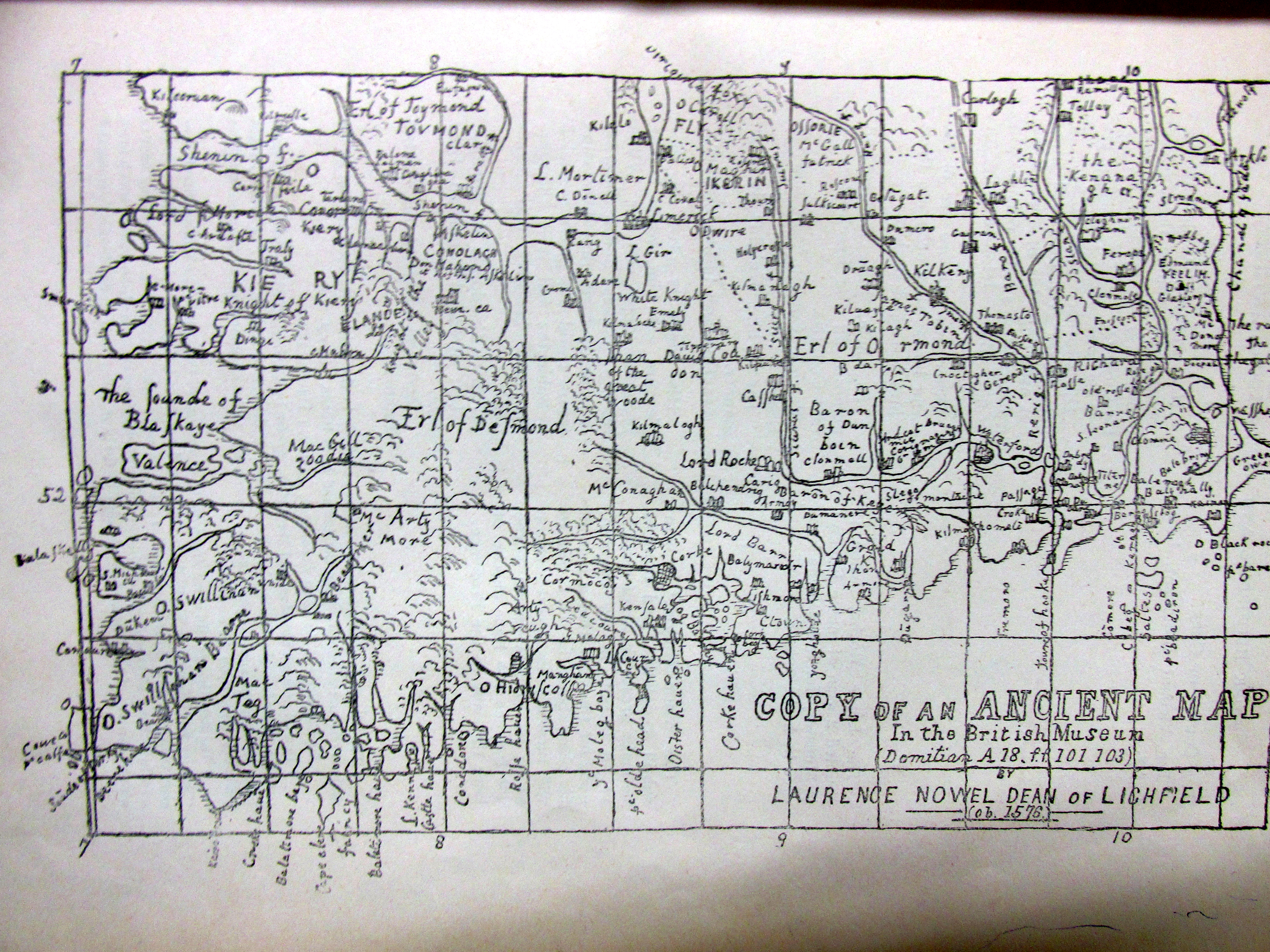
Map of Co.Cork and Kerry, 1575. 06 Friday Feb 2015 Posted by durrushistory in Uncategorized ≈ 2 Comments Tagscork, kerry Map of Co.Cork and Kerry, 1575. Share this: Share on X (Opens in new window) X More Share on Facebook (Opens in new window) Facebook Like Loading...


Pingback: Frances Jobson’s Map of West Cork, 1589 including Cape Clear, Baltimore, O’Driscolls, Rosbrin, Crookhaven, Bantry, Muintervara land of Rymers (O’Daly’s Bardic School), O’Sullivan Bere. | West Cork History
Pingback: Frances Jobson’s Map of West Cork, 1589 including Cape Clear (Iniskyran), Baltimore, O’Driscolls, Rosbrin, Crookhaven, Bantry, Muintervara land of Rymers (O’Daly’s Bardic School), O’Sullivan Bere, Priest’s Leap. | West