
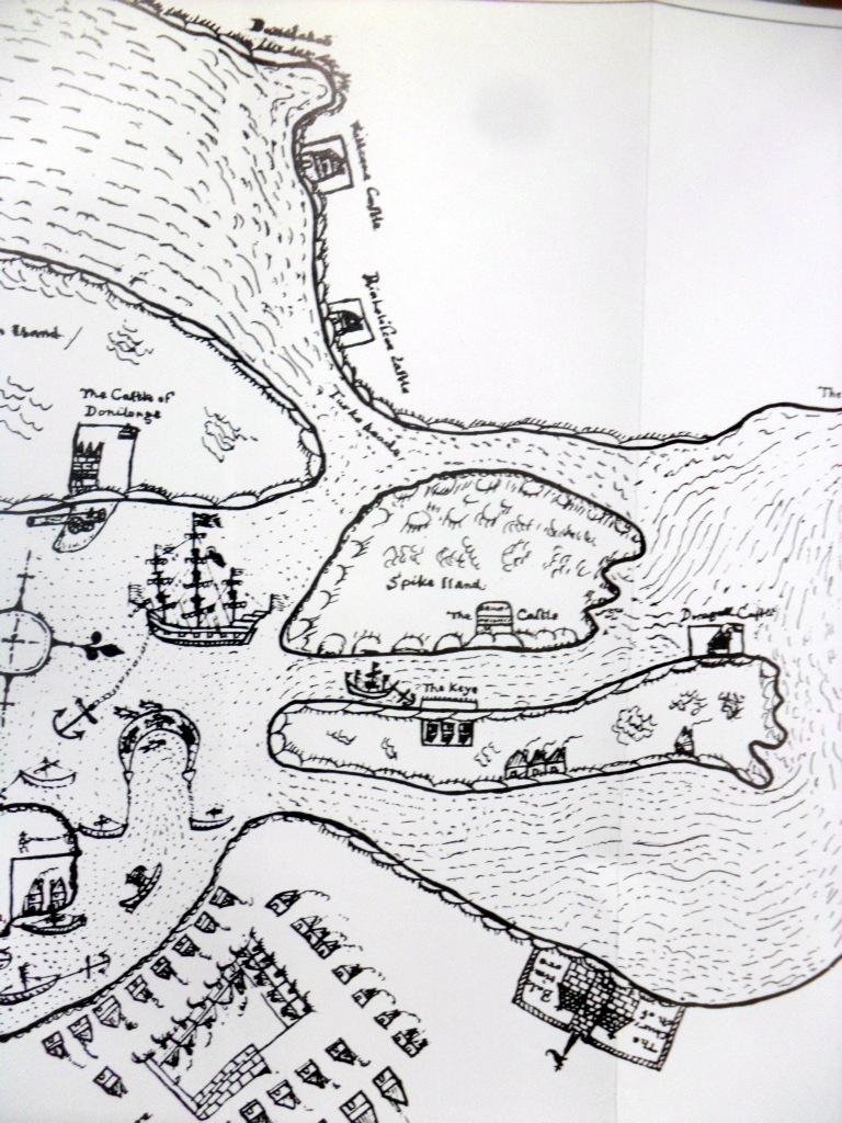
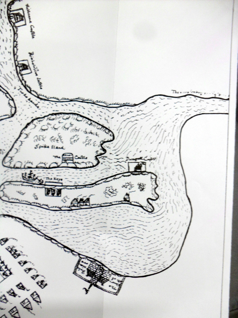
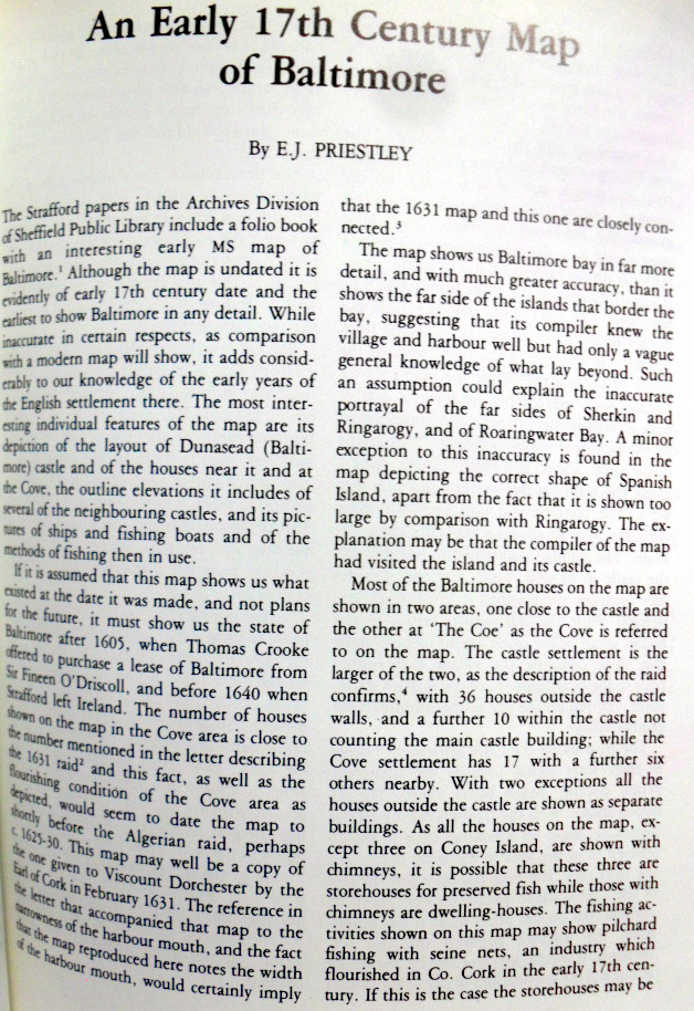
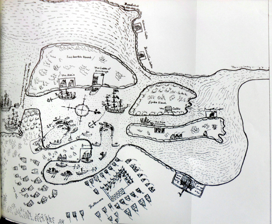
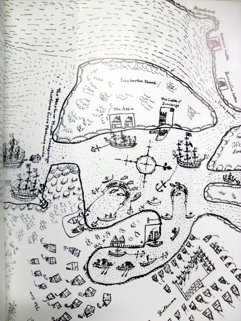
Early Map of Baltimore, West Cork (Between 1605-1640), showing English Settlement, Dunasead Castle, Loo Rocks, Storehouse for Preserved Fish, 12 Fishing Boats, Seine Pilchards, 5 Possible Royal Navy Boats.
Courtesy JCHAS, 1984.
Some time after the Port was raided by Algerian Pirates.
http://en.wikipedia.org/wiki/Sack_of_Baltimore
The Baltimore Fishery was part of a larger fishery including Leamcon, in Schull controlled by Sir William Hull, that of Whiddy Island rented by Davenant from O’Sullivan Bere and that of Cornwall. Hull may have had another fishery in Newfoundland. The fisheries were financed by London merchants.

Pingback: Frances Jobson’s Map of West Cork, 1589 including Cape Clear, Baltimore, O’Driscolls, Rosbrin, Crookhaven, Bantry, Muintervara land of Rymers (O’Daly’s Bardic School), O’Sullivan Bere. | West Cork History
Pingback: Léim an tSagairt (Priest’s Leap) 1612 or possibly Earlier from Francis 1589 map | West Cork History
Reblogged this on West Cork History.
LikeLike