
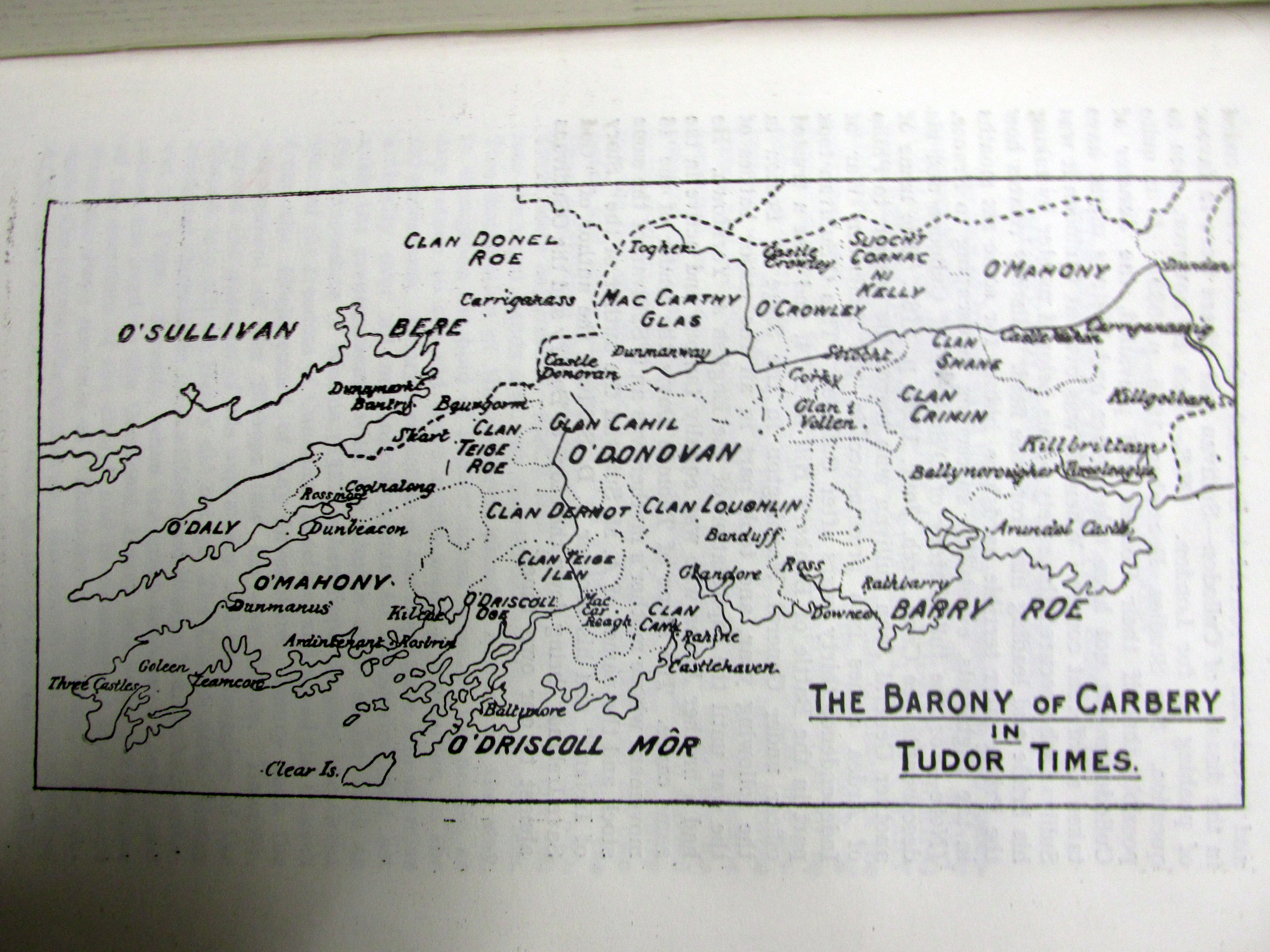
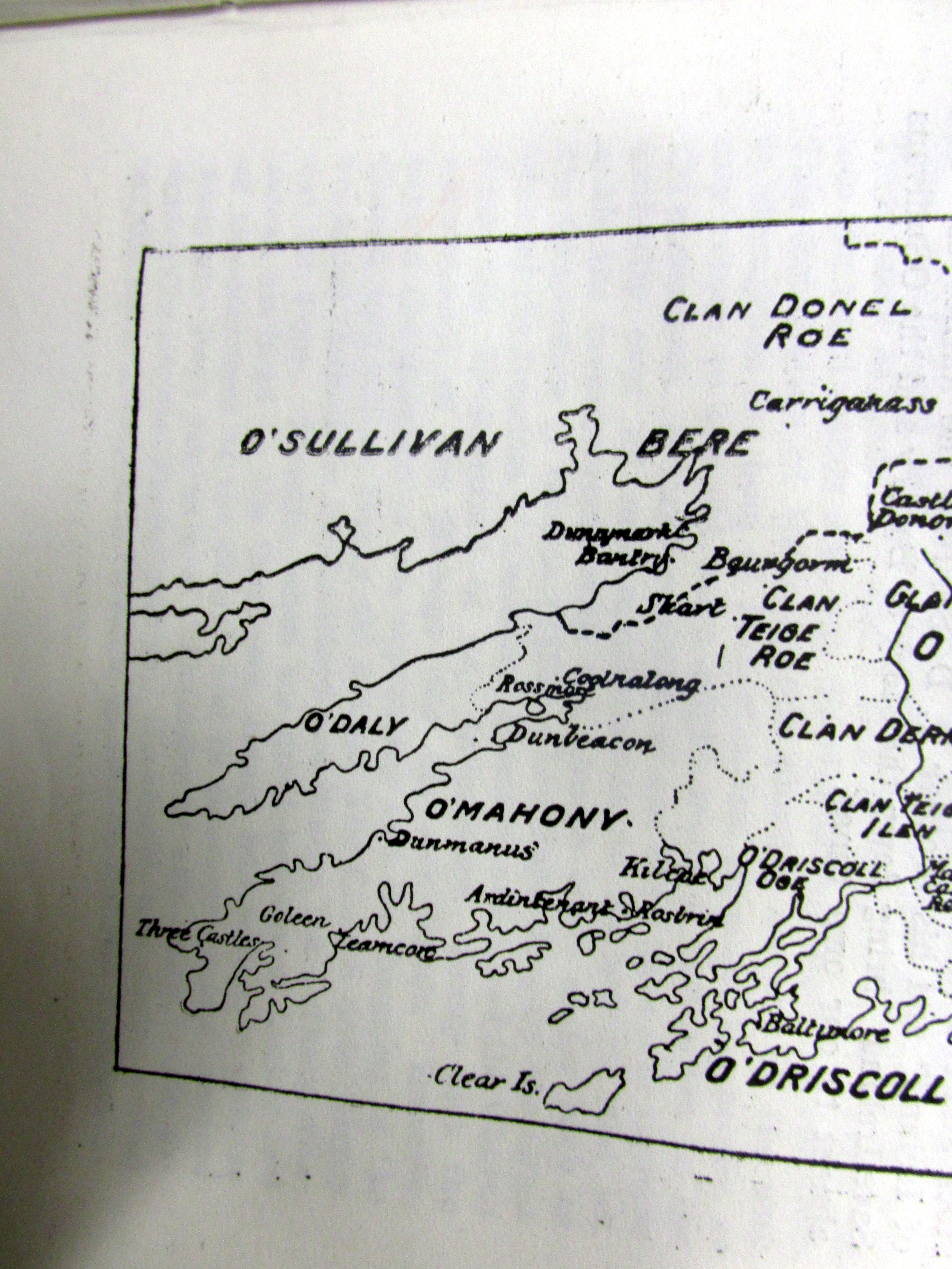
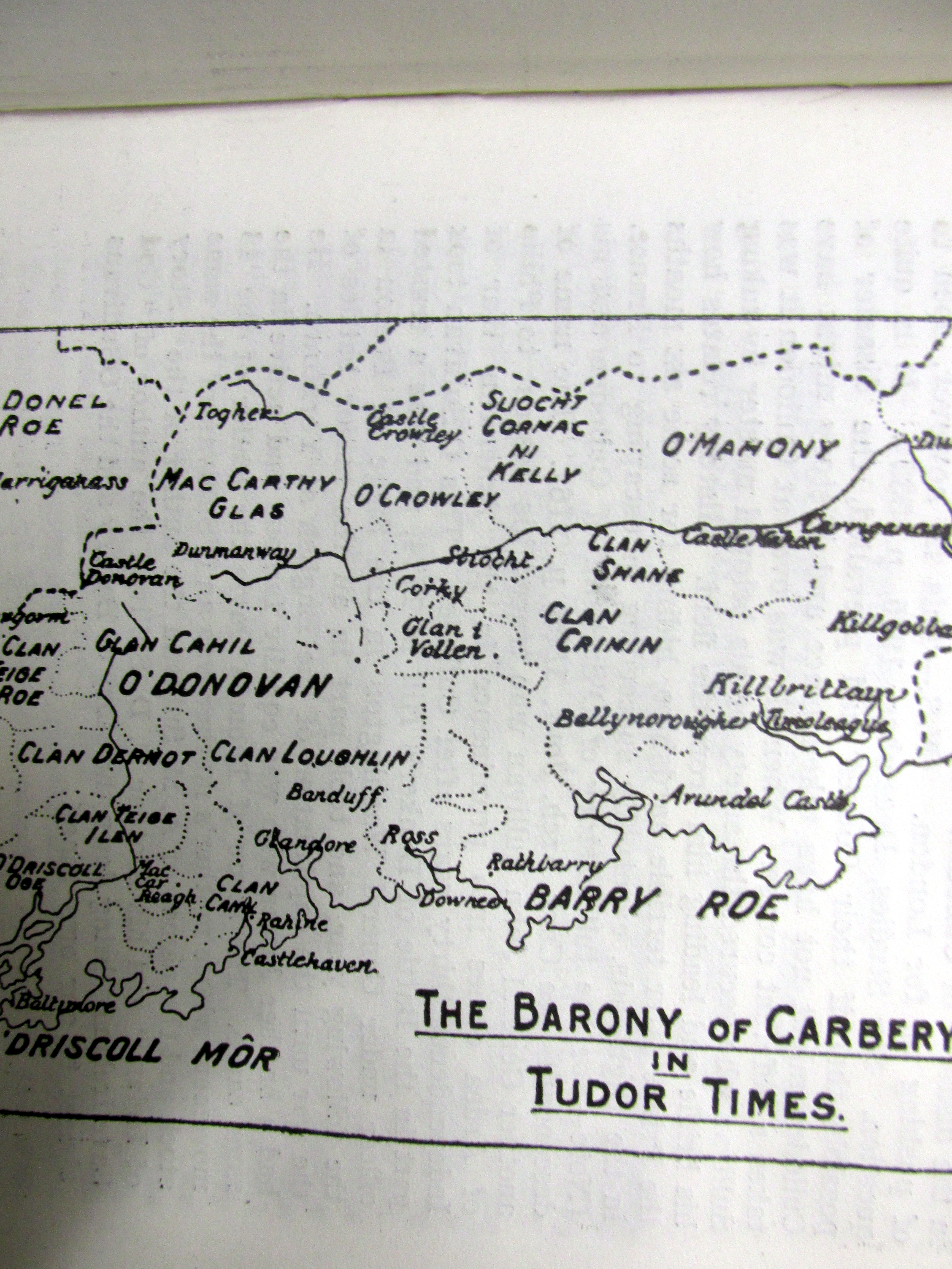
Map of Carbery West Cork in Tudor Times.
Taylor and Skinner Maps:
https://durrushistory.wordpress.com/2012/09/08/taylor-and-skinner-maps-of-west-cork-1777/
Speed Map:
https://durrushistory.wordpress.com/2014/11/15/john-speed-map-of-west-cork-1630/
Townland Maps:

Pingback: Frances Jobson’s Map of West Cork, 1589 including Cape Clear, Baltimore, O’Driscolls, Rosbrin, Crookhaven, Bantry, Muintervara land of Rymers (O’Daly’s Bardic School), O’Sullivan Bere. | West Cork History