Seizure of Friars in Bantry, 1667

Tags


These documents are held at Oxford University, Bodleian Library, Special Collections and Western Manuscripts

Ormond to Orrery: written from Dublin MS. Carte 48, fol(s). 77 8 January 1667

Copy

Contents:
Sir Arthur Denny’s Narrative enclosed with Lord Orrery’s letter of the 4th inst is long and consists of more particulars than can now be noticed. Upon the whole matter, the Duke thinks that Sir Arthur has acted with much discretion… but it may be fit not to pursue it further… Lord Orrery has done well to seize upon the Friars in Bantry; and those of Quin should be dealt with in like manner… The Duke is sorry that his cousin Daniel O’Brien gets him not a better sort of Chaplains. It may raise a suspicion of him – such, it is hoped, as he will never deserve …

List of Undertakers for Munster 1591


The UNDERTAKERS in MUNSTER. MS 617, p. 164 1591

These documents are held at Lambeth Palace Library

Former reference: MS 617, p. 164

4 Pages.

Supplementary information: Calendar of the Carew Manuscripts preserved in the Archiepiscopal Library at Lambeth, ed. J. S. Brewer & W. Bullen (6 vols., 1867-73), vol. III, document 128.

Contents:
“Munster.–An Abstract or brief particular of all the Names of the Undertakers, the several counties, the quantity of their lands, and their yearly rents.”
Waterford.–Sir Chr. Hatton, late Lord Chancellor of England, hath in demesne and rentable lands (at the rate of 428½ acres, English measure, to a plowland) 10,910 acres; yearly rent from Mich. 1591 for three years, 30l. 3s. 9d. ster., and from Mich. 1594 in perpetuity, 60l. 7s. 9d. ster. Sir Walter Rawleighe, rentable lands, number unknown; yearly rent from Mich. 1591 for three years, 50 marks ster., and afterwards 100 marks. [Sir Walter’s lands are stated to be in cos. Waterford and Cork, and the following note is placed in the margin:–“He had these lands by express words and warrant in a special letter from her Majesty at 100 marks per annum rent.”]
Kerry.–Sir Edward Denny, 6,000 acres; rent for three years 50l., afterwards 100l. “He hath also the collection of chief rents in his patent to the sum of 300l.; also 80 beoffes. The country being depopulate, this rent was never answered by him, and we find that the Earl [of Desmond] never received half so much, and when he received any, it was in warlike manner upon the country of Clanmorryes, being the territory of the Baron of Lixnawe, who, being enforced thereunto by our distresses taken upon his lands, hath compounded for 50l. ster. per annum, as parcel of the composition of Kerry.” The rents payable by Sir William Harbarte, Mr. Charles Harbarte, Mr. John Hollis, Captain Jenken Conwaye, and John Champion are specified.
Cork.–Sir Warham St. Leger, Hugh Cuffe (who has granted to William Power the half of his seignory), Sir Thomas Norreis, Arthur Robins, Arthur Hyde, Phane Becher and Hugh Worth, Thomas Say, Edmond Spencer, Richard Beacon. [The lands held and rents payable by these Undertakers are specified. Spenser had 3,028 acres in co. Cork, his rent for the first three years being 8l. 13s. 9d., and from Mich. 1594, 17l. 7s. 6½d.; chief rents, 33s. 4d.]
Limerick.–Sir William Courtneye, Francis Barkley, Robert Ansloe, Richard and Alexander Fitton, Edmond Manwaringe, Sir Edward Fitton (also in cos. Waterford and Tipperary), William Trenshard, George Thorneton, Sir George Bourcher, Henry Billingslye.
Tipperary.–Thomas Earl of Ormonde and Osserie.
Totals.–Acres, 202,099. Rents, 1,976l. 7s. 5½d. ster. after Michaelmas 1594.
The Undertakers pay for their demesne lands but half of their rents till Michaelmas 1594.
Chief rents, 1,022l. 13s. 8¼d.
Abatements of rents upon evictions, 55l. 7s. 1d. Remain of the Undertakers’ rent till Michaelmas 1594, 967l. 6s. 7¼d.
Abatements of rents upon evictions per annum till Michaelmas 1594, 80l. 4s. 3d. There remaineth therefore to be paid yearly to her Majesty after Mich. 1594, 1,896l. 3s. 5½d. (sic.)
Signed: Ro. Gardener, Roger Wilbraham.
Copy.

Commission to Enquire into Escheated Lands In Munster 1586 including Fishery at Bere Haven, Bantry.

Tags


ESCHEATED LANDS. MS 617, p. 176 1586

These documents are held at Lambeth Palace Library

Former reference: MS 617, p. 176

4 Pages.

Supplementary information: Calendar of the Carew Manuscripts preserved in the Archiepiscopal Library at Lambeth, ed. J. S. Brewer & W. Bullen (6 vols., 1867-73), vol. II, document 606.

Contents:
“Instructions to be annexed to the commission for the inquisition of the state of the tenants and occupiers of the lands and territories escheated to her Majesty by attainder of the late Earl of Desmond and others, for their treason in Munster.”
(1.) The Commissioners to make inquisition of all the occupiers, and how many have sued out letters patent, and how the patentees have observed their covenants for the inhabiting of the lands with English people, and what profits they have received; and to charge them to be ready to pay the rents, which are to be paid this year after Michaelmas.
(2.) The Lord President, Vice-President, and chief officers of Munster to collect the said rents, except such as are payable into the Exchequer.
(3.) To inquire again into all titles and claims against the patentees and their officers, and by jury or otherwise to establish a final order therein, whereby the possession of the undertakers, grantees, and patentees may be settled.
(4, 5.) To inquire in what sort the escheated lands were chargeable to the Earl of Desmond and to others, whether attainted or not.
(6, 7.) To determine all contentions touching boundaries, divisions, tithes, spiritual rights, &c.
(8.) The Commissioners who are not of the Council of the province to consider of all informations made touching the cesse and other exactions taken by the President, sheriffs, or other officers contrary to the tenour of the establishment; and to set down order for the reformation thereof.
(9.) To deal with the lords and freeholders for a composition in lieu of cesse, such as is in Connaught, and to draw into that composition as well the undertakers as the residue of the country.
Signed by the Privy Council in England: Chr. Hatton, canc.; W. Burghley; Ch. Hauward; [H.] Hunsdon; F. Knowles; Thom. Heneage; Ro. Cecill; J. Wolley; J. Fortescue.
II. “Additions to the former Articles.”
(1.) The Commissioners to inquire of all leases and mortgages supposed to have been made by the rebels before they entered into action, and which are thought to be fraudulent. The claimants to make good proof.
(2.) To decide all controversies between the undertakers for passing the self-same lands in divers patents.
(3.) “To inquire how the sheriffs do keep their law days and county days within every county, for it is openly reported that the sheriffs are accustomed to devour the people in every barony or cantred with kerne and horsemen, or else to compound with the lord, and so leave the lords to their wonted parliaments, exacting from the freeholder[s] and poor men what they please.”
(4.) Controversies to be decided between the lords and the freeholders, so that the latter may depend wholly on her Majesty.
(5.) “That the charters of the cities be perused, who, claiming all forfeitures to themselves, care not what they commit, compounding beforehand for all recognizances and bands, and thereby transport out of the realm not only all kind of prohibited wares, to the utter impoverishment of the commonwealth, but maintain priests and Jesuits, and hear mass publicly.”
(6.) “That they inquire of the two cantreds or baronies of Coursy and Kinally, whether Sir Barri Oge, called Sir Robert Barrey, and the Lord Coursey, having but estate in tail, the land be not in remainder to her Majesty, neither of them having issue; and to inquire whether Sir Robert be seneschal or inheritor of the barony of Kinaley.”
(7.) Whether the customs of fishing at Beare Haven, Bantry, [and] Ballatimore be not belonging to the Queen.
III. “Articles which are to be inquired of by the Commissioners, not being of the Council of Munster.”
(1.) To inquire of all beefs, corn, &c. taken up by the Governor[s] and cessors at the Queen’s price; how much the Queen is thereby indebted to the country, and the Governors to her Majesty, &c.
(2.) How her Majesty is answered of all her fines and forfeitures of bands.
Signed: Chr. Hatton, canc.; W. Burghley; [H.] Hunsdon; Tho. Buckhurst; F. Knollys; R. Cecill; J. Wolley; J. Fortescue.
Copy.

List of Irish Shipped to Spain from Castlehaven, 1601

Tags


EMIGRANTS to SPAIN. MS 601, p. 235 1602

These documents are held at Lambeth Palace Library

Former reference: MS 601, p. 235

4 Pages.

Supplementary information: Calendar of the Carew Manuscripts preserved in the Archiepiscopal Library at Lambeth, ed. J. S. Brewer & W. Bullen (6 vols., 1867-73), vol. IV, document 205.

Related information: Pacata Hibernia, p. 424.

Contents:
“Anno 1601. A List of the Names of so many of the Irish as have shipped themselves for Spain forth of Munster, since December 1601, besides divers depending upon these, and many others whose names I know not.”
From Castlehaven in December 1601 with the Adelantado, O’Donnel, Redmond Bourke, Hugh Mostian, and their train, the number whereof I know not.
O’Sulyvan Beare’s son, and with him one Traunt of the Dingle from Beare-haven, in February 1601[-2].
Donnel, son to Sir Fynnen O’Driscoyle, from Castlehaven with the Veedor Pedro Lopes de Soto.
From Kinsale with Don John in March 1601:–Teige MacDonnell ne Countey, a cousin-germain to Cormack Mac Dermonde, Lord of Muskrie; William McShane, the Seneschal’s son of Imokelly; Dermot McConougher O’Driscoyle, of Castlehaven, with his brother and son; Thomas O’M[o]rhine, alias Thomas Keagh McEdmond, of Muskerry, a horseman (his father is with O’Callaughann); Richard Myagh, son and heir to James Myagh, of Kinsale; Domynicke White, of Kinsale, a carpenter’s son; Melaughlin More, of Kinsale, born in Connought; Conoughor O’Menone, of Kinsale, born there; Edmond McThomas, of Kinsale; Dermot McShane, of Kinsale; Donough Deasagh, of Kinsale; Andrew Butler, born at Galway, a kearne; William Butler, brother to Andrew, a kearne; Mahowne McDonnough O’Lyne, dwelling under Barry Oge; Dermot McOwen, a shot; David Fitz Garrat Barry, his wife and children, dwelling at Rincorran in Barry Oge’s country; Garrot, Nicholas, John, and David Oge Barry, sons to David FitzGerrat Barry abovesaid; William Hartluge, of Rincorran; John Hartluge, son to William; Dermot Oge O’Sulyvane, of Rincorran; Dermot O’Griffen, of Rincorran; John McDonnell Keady, of Rincorran; Dermot McDonnell Keady, brother to John; Morris Roche Fitz John, of Ellenfinchtowne in Kynallea; John FitzJohn Roche, a brother to Morrice; Conougher McDonnough, of Rathmore in Kynallea; Donnell Gowe, a Connoughtman, dwelling at Rathmore; Hugh O’Healy, a Connoughtman; Donnoug Moel McEnestlis, Dermot Moel McCartie’s man; Owen McDonnough McFynnen Cartie, of Currowrane, Donnel Oge McDonnel McFynnen McCarty, brother to Don Carlos Carty, slain at Kinsale; Fynnen Oge Cartye, brother also to Don Carlos; Conougher O’Cullenane, of Rathmore in Kynalea; Donnell O’Griffen, of the same; William McCormock, Dermot McShane, Edmond O’Lavien, William McRichard, and Cormocke O’Lanehie, all Connoughtmen; Dermot Deasagh, of Carbry; Dermot O’Longie, of Muskry; Richard Gogaine FitzPhilip, of Barnehelly in Kyrrywhirry; Fynnen McDonnough Cartie, a cousin to Don Carlos; Dermott McFynnen Carty, of Skeath in Carbry, and Donnell McFynnen Carty, of the same, brothers; Donnell McTeige Carty, of the same; David Skemnehan, of Rincorran; John McDermott McShane, a Connoughtman; Dermot MacShane, a Connoughtman; Cormocke, the Lord President’s footman, of the Birnes in Leinster; William McShane, of Rathmore in the county of Lymericke; Donnell McShane O’Cullenan, of Rathmore in Kynallea; John Oge O’Lensy, a Connoughtman; Teige Walsh, alias Teige Brennagh; Cormocke McDonnough ne Mroen O’Riordane, Dermot McDonnough ne Mroen O’Riordane, and Owen McDonnough ne Mroen O’Riordane, all of Muskerry, brothers; Donnell McShane O’Riordane, of Muskerry; John Feild FitzMorrice, of Tracton Abbey; John Roe McWilliam, of the county of Lymericke; Donnell O’Sisnane, of Kinsale; Teig O’Sisnane, son to Donnell;–Hugh Lassye, Walter Lea, of Kilkenny, Richard Stacboll, and one FitzJames, a pensioner, who came with Don Juan to Kinsale, and returned thence again with him.
From Ardea, in the Patache, the 7th of June 1602:–Donnough, bastard brother to Florence McCarty; Donough McMahon O’Bryan McEnaspicke, of Tomond; Bryan O’Kelly, a captain of Bowines, and a Connoughtman.
With Connor O’Driscoyle and James Archer, the 6th of July 1602:–Connor O’Driscoyle, eldest son to Sir Fynnen O’Driscoyle; James Archer, Jesuit; Colly McSwyny McEdmond, of the McSwynes, of Carbry (his son Owen was hanged at Donboye, in June 1602); Cormock McDonnough, Vic Donnell Rabbing, one of the Carties; Donoug McConnor Vic Vic Donnough, of Glanbarathaine, (in English called Castellhaven, and owner of it; he is of the O’Drischalls); Donnell McConnor Vic Dermodi O’Driscoyle; McCon McIffie O’Driscoyle, Teige McIffie O’Driscoyle, and Moriertaugh McIffie O’Driscoyle, brothers; Dermod McConnor Vic Dounes, of Kilkoe, one of the Carties, and Conor Oge, of the same, brothers; Shane McDermody Iholoughane, of Bantry; Shane McGyllycuddy Iholoughane, of Beare; Teige Oge, ne Mocklaughe, one of the Carties, and Owen McTeige ne Mocklaughe, brothers; Fynnen McBrowne, one of the O’Driscoyles; Connor O’Mahowny, of Lenicon Lemcon Schull), one of the O’Mahons of Ivaghe, one of the sons of Gulleduffe of Cleare, one of the O’Driscoyles; Dermott Oge McDermody O’Driscoyle; Connor McFynnen Roe, of Bonnane in Bantry; Terlaugh, son to Teige Keagh McMahowny, of Thomond (he slew his father when Donboy was besieged; his lands her Majesty hath given to the Earl of Thomond’s brother); Shane O’Kahan, of Thomonde; Dowaltaugh McMorrough I Corromaine, a foster-brother to O’Donnell, and an Ulsterman; Ellyne ny Donnough, late wife to Dermot Moel McCartie, brother to Florence McCartie in the Tower; Fynnen Kearigh, of the Fyall, one of the Carties; Dermot McShanaughane, a Rymer; Gulleduffe, a Thomondeman; two soldiers of Thomonde, whose names not known, but serving under Connor O’Driscoyle; David McShane, servant to James Archer, the Jesuit (son to John Rice, of the Dingle); Shane McDermody Vic Donnough Oge I Cullaine, Archer’s boy; Connor Oge O’Driscoyle, son and heir to Connor, son to Fitz Fynnen (nine years of age); Thomas, son and heir to the Knight of the Valley (14 years old); Donnell O’Mahowny, a mariner that came in company with Owen McEigan; five Frenchmen that were taken by Teige Keagh McMahowny, when he took the ship and merchant of Galway.
Signed: George Carew.
At the end in Carew’s hand:–This note was sent into England to the Lords of the Council by Sir George Carew, knight, Lord President of Mounster.
Copy.

Felons and Vagabonds from Co. Cork 1736-43 ordered for Transportation from the Journal of the Irish House of Commons.

Tags

,


County of Corke [Cork?]
A List of several convict felons and vagabonds ordered for
transportation, for whom money was raised on the said County, and
the several sums raised for that purpose for these seven years last
past.
#PAGE 15
The respective Names of convicts Sums raised and to l.
assizes felons and vaga- whom ordered
bonds ordered for
transportation
Lent assizes.
24th March, 1736 John Dawley |
Cornelius Coughlan |
Richard Hagarty |
John Street | Seventy pounds to
Honor Crotty > William Delaboide 70
John Shaggareen |
als. Berry |
James English |
John Sullivan |

Daniel Crowley |
Timothy Duane |
Joanna Carthy | Seventy pounds to
Charles Crowley > William Delaboide 70
John Connor |
Dennis Sullivan |
otherwise Cullitagh|
Same assizes William Connor > Eight pounds to
Patrick Roach > William Sweet 8

Summer assizes No money presented
1st August 1737
Lent assizes No money presented
18th March 1737-8 Timothy Carthy |
Summer assizes. Owen Sheehy |
25th July 1738 Bartholomew Garalaght |
John Bryan | Fifty-four pounds
Patrick Gould > to William Sullivan 54
Thomas Walsh |
Timothy Shea |
Samuel Price |
Michael Nunane |
Same assizes John Bennet Four pounds to
Mary Fitzgerald Samuel Lowthen 4
Lent assizes Timothy Connell
10th April 1739 John Murphy
Lent assizes Mary Bryan | Twenty-one pounds to
John Murhahy | Robert Williamson for
Robert Morcarty > these and foregoing
James Kelly | three 21
#PAGE 16
Same assizes Philip Hauraham | Twelve pounds to
James Pickett > John Baldwin 12
William Roach |

Summer assizes No money presented
16th August 1739
Lent assizes No money presented
22nd March 1739-40
Summer assizes No money presented
29th July 1740
Lent assizes No money presented
17th March 1740
Summer assizes James Kelly
27th July 1741 John Harrington
Mary Fitzgerald
Dennis Carty
Summer assizes Catherine Hamilton |
27th July 1741 Teigue Bryen |
John Ryan |
Peter Murphy |
Daniel Cullane |
Timothy Connell | Fifty-four pounds to
John Murphy | Robert Williamson for
Margaret Crimmeen > those and the four
Matthew Bright | foregoing 54
John Merrihy |
Mary Bryan |
John Lemmee |
Robert Moriarty |
Darby Murphy |

Same assizes Margaret Sullivan |
Thomas Adams |
James Mahony |
Darby Driscoll |
John Carthy |
Timothy Leary |
John Sullivan |
Nathaniel Williams > Fifty pounds to ditto 50
Pierce Butler |
Chatherine Barrett |
Philip Murphy |
John Smith |
Cornelius Crimmeen |
John Long |
#PAGE 17
Lent assizes Timothy Murphy |
31st March 1742 David Dillane |
Richard Hennesy |
Catherine Buchilly |
Joan Nihane | One hundred and
Malachi Madden | fifty-five pounds to
Daniel Hagarty | Robert Travers for
James Connell other-| these and the
wise John Sheehan > fifteen following 155
Dennis Crowley |
Edmund Mulcahy |
Owen Hickey |
Daniel Murphy |
John Shealy |
William Johnson |
Timothy Dawly |
Michael Forrest |
Lent assizes Teigue Murphy
31st March 1742 Charles Regan
Daniel Sullivan
Daniel Donovan
Michael Coskry
John Sheelan
Dennis Mullane
Michael Murphy
Dennis Commane
Dennis Bryen
John Roache
Thomas Sheehan
Maurice Spillane
Timothy Coskry
John Bourke
Summer assizes
20th August 1742 No money presented
Lent assizes Darby Mahony |
18th March 1742-3 Dennis Driscoll |
Patrick Sheehan |
Ellenor Sullivan |
Cornelins Donahoe |
. Daniel Scannell |
John Connor | Sixty pounds to
Timothy Regan > Robert Williamson 60
Timothy Donohoe |
David Condon |
Timothy Carroll |
John Ronan |

#PAGE 18
Michael Holland |
Thomas Fitzgerald |
Patrick Rayne |

Summer assizes Patrick Lynchy |
9th August 1743 Cornelius Grany |
Maurice Killigott |
John Connor |
Patrick Lewis |
Daniel Bryan | Eighty pounds to
Darby Collins | Robert Williamson for
John Barry > these and the six
John Donoghoe | following 80
Nicholas Kearny |
Julian Murphy |
Ellenor Cahane |
Ellenor Roache |
Elizabeth Ivers |
Summer assizes Catherine Sullivan
9th August 1743 Margaret Linnahane
Ellenor Ginnanane
Margaret Jones
Catherine Harrington
Mary Shannahane
—-
Total 566

County of Corke I Certify that this is a true list of all convict
[Cork?], To wit. felons and vagabonds ordered for transportation
for these seven years last past, and that the
sums in said list were raised for those purposes.
Dated this thirteenth day of December 1743.
John Purdon, Clk. Cor.

City and County of the City of Corke [Cork?]

A List of all convict felons and vagabonds who have been ordered
transportation in and for the City of Corke [Cork?] for these
seven years last past, with an account of what money hath been
raised for those purposes.

At a general assizes and William Knockins > Presented
general goal delivery held Ann Mc. Daniell > as vagabonds
for the County of said
City the twenty-fifth of
August 1736.
#PAGE 19
Elizabeth Keeff |
otherwise | At the same assizes the sum
Lynchy | of twelve pounds was raised
Julian Croneen | Convict and ordered to be paid to
James Barrett > Felons John Baldwin, Esq., for
Darby Lyne | transporting to America
Tim. Sullivan | Winnefred Kelly, Miles
otherwise | Sweeny and Dennis Mahony
Randam | otherwise Saxon, felons
convicted at the last
John Collins | assizes.
William | Presented
Fitzgerald | by the At an assizes held the
Dan. Hennelly > grand jury sixteenth of August 1739.
otherwise Duff | as
Susanna Crowly | vagabonds Maurice Heas | Convict
Timothy Deashiah > felons
At the same assizes, the sum Ellenor Mohony |
of thirty pounds was raised Mary Ryan other- |
and ordered to be paid for wise Sweeny | Presented
William Delahoide for Margaret > as
transporting to America John Fitzgerald | vagabonds
Fitzgerald, James Murphy, otherwise Ryan |
Daniel Donovan, Margaret Patrick Ryan |
Donohoe, Joan Croneen other- William Ryan |
wise Murphy and Thomas Dyer
otherwise John Keef, six At an assizes held the twenty-
felons convicted at a former second of March 1739
assizes.
At a Sessions of Oyer and Margaret Hurly |
Terminer held for the George Armstrong | Convict
County of said City the William Sexton > felons
eighteenth of November 1736. Florence Carthy |
Elizabeth Carroll|
John Vaughan |
Mary Bastard | John Boyle | Presented
Jane Carroll | otherwise Bryan > as
Mary Minister | John Finally | vagabonds
John Godfrey |
otherwise | At the same assizes the sum of
Magrath | thirty-nine pounds was raised
Rickard Donovan | Felons and ordered to be paid to
Ann Murphy > convict Robert Williamson for trans-
otherwise | porting to America Timothy
Lombard | Denashiah, Mary Ryan, Margaret
Julian Sullivan | Ryan, William Ryan, Maurice Heas,
#PAGE 20
Michael | Ellenor Mahony, William
otherwise | Knockins, Mary Harrington, Rose
William Kent | Nagle, Cornelius Donoghoe,
John Murphy | Thomas Keareen, John Kelly and
William Fitzgerald, felons and
Bryan Carrick | Presented vagabonds under rules of
Darby Clearly > as transportation.
| Vagabonds
At an assizes held the twenty-
At an assizes held the ninth of July 1740.
twenty-fourth of March 1736.
Owen Callaghan | Convict
Maurice Bryan | Call. Mc. Callaghan > felons
otherwise Gillane| Joan Lynch |
Philip Daunt the |
elder | Felons Joan Coleman | Presented
Phil. Daunt the > convict Richard Seehane > as
younger | Thomas Healy | vagabonds
Mary Daunt |
Dennis Kelly | At an assizes held the seventeenth
of March 1740.
The same assizes the sum of
seventy three pounds ten Catherine Sweeny, Ellenor Kealiner,
shillings was raised and Elizabeth Murphy, Honor Cavenagh,
ordered to be paid to otherwise Welsh, Honor Scannell,
William Delahoide for trans- Ellenor Magher, Mary Hickey other-
porting to America Mary wise Meany, otherwise Jane Hicks,
Bastard, Mary Minister, John Julian Purcell.
Godfrey otherwise Magrath,
Rickard Donovan, Julian All being in custody under
Croneen, James Barrot, sentence of death for divers
Darby Lyne, Timothy felonies by them committed, and
Sullivan otherwise being reprieved for several years
Randam, William past, at this assizes, severally
Fitzgerald, John Crawly, pleaded his Majesty’s pardon
Bridget Kennelly, Michael conditionally to be transported,
Eyers, Daniel Kennelly, John and they were ordered to be trans-
Collins, Susannah Crowly, ported accordingly.
William Lyne otherwise Lyons
Henry Jacques, John Sullivan, Michael Collins |
Ann Murphy, otherwise Morgan Gallery > Convict
Lombard, Julian Sullivan Lewis Leary | felons
and Michael, otherwise
William Kent, twenty-one Garret Connor |
felons and vagabonds. otherwise Bane | Convict
John Lee > felons
#PAGE 21
At an assizes held the Margaret Bush |
first of August 1737.
Margaret Healy | Presented
John Mortimore | Presented otherwise Bryan > as
James Twomey | as Roger Connor | vagabonds
George Stanley > vagabonds
Mary Guily | At the same assizes the sum of
thirty-five pounds were raised and
At the same assizes the sum ordered to be paid to George Fuller
of three pounds ten the younger and William Clarke,
shillings was raised and Esqs. Sheriffs, for transporting
ordered to be paid to John to America, Ellenor Kealiher,
Baldwin for transporting Elizabeth Murphy, Honor Cavenagh,
to America Maurice Bryan, otherwise Welsh, Honor Scannell,
otherwise Gillane, a felon Ellenor Magher, Mary Hickey
convicted at the last otherwise Meany otherwise Jane
assizes, and seventeen Hicks and Julian Purcell, felons
pounds ten shillings under rules of transportation.
raised to be paid William
Delahoide for transporting At an assizes held the twenty-
Bryan Carrick, Phil. seventh of July, 1741.
[Philip?] Daunt the elder
and younger, and Mary Maurice Fitzgerald > Convict
Daunt and Dennis Kelly Ellenor Dawley > felons
Owen Culloghty |
otherwise Kilty | Presented
At an assizes held the John Scannel the elder > as
eighteenth of March 1737. John Scannel the young-| vagabonds
er |
George Austen |
| Convicted Patrick Raines |
Catherine | of Perjury At the same assizes the sum of three
the wife of | and pounds was raised and ordered to be
James Murphy > ordered to paid George Fuller the younger, Esq.,
| be trans- one of the Sheriffs, for transporting
| ported to America Catherine Sweeny who was
under the rule of transportation, and
Barbara Bourke> Convict and also the sum of seventy-five pounds
Joan Browne > felons sterling, was presented and ordered to
be paid Robert Williamson, for trans-
Patrick Byrne | porting to America Michael Collins,
Joan Wheeler | Lewis Leary, Garret Connor, John Lee,
James Barron | Presented Roger Connor, Cornelius Sheehan,
Ellen Connor > as Margaret Bryan, Margaret Bourke,
otherwise | vagabonds Morgan Gallery, Cornelius Donaghoe,
Reaper | Thomas Keareen, John Kelly, William

#PAGE 22
Joan Lynchy | Fitzgerald, Owen Callaghan,
Callaghan MacCallaghan, Joan Lynch,
At the same assizes the sum John Coleman, Richard Sheehane,
of fourteen pounds was William Sexton, Elizabeth Carroll,
raised and ordered to be Joan Field, Margaret Hurly, John
paid to William Rickotts Bryan, George Armstrong and
for transporting to America Florence Carthy, who were under
John Murphy, John Vaughan, rules of transportation.
George Stanley and Mary At an assizes held the thirty-first
Guily, four felons and of March 1742.
vagabonds under rules of Jeremiah Mahony |
transportation. Cat.Dogherty other-|
wise Prendergast |
Bridget Clarke | Convict
At an assizes held the James Shinnick > felons
twenty-fifth of July 1738. John Shinnick |
Dennis Mc. Carthy |
Charles Carthy |
Den. Mahony |
otherwise | Convict John Hennessy |
Saxon > felons Barthol. Bourke | Presented
Winifred Kelly| Edmond Keane > as
Miles Sweeny | Darby Madden | vagabonds
Charles Sullivan |
John Parker | Presented Richard Flemming |
otherwise > as a Mary Benson |
Flanagan | vagabond At the same assizes the sum of
twenty-eight pounds was raised and
At the same assizes the sum ordered to be paid to Robert
thirteen pounds fifteen Travers. Esq., for transporting to
shillings was raised and America John Scannell the elder,
ordered to be paid to John Scannel the younger, Owen
Horatio Townsend Esq., for Culloghty, George Austin, Pat. Raines,
transporting to America, Maurice Fitzgerald and Ellenor Dawley,
Barbara Bourke, Joan were under rules for transportation.
Browne, Catherine the At an assizes held the sixteenth
wife of James Murphy, of August 1742.
James Barron and Patrick John Lynchy | Convict
Byrn, under rules of James Bryan other-> felons
transportation the last wise Sowny |
assizes. John Dawly |
John Mahony > Presented as
At an assizes held the > a vagabond
tenth of April 1739. At the same assizes the sum of fifty-
six pounds was raised and ordered to
Mary Harrington| be paid to Robert Travers, Esq., for
#PAGE 23
Rose Nagle | transporting to America, [. . . torn]
Cornelius | Convict Mahony, Catherine Doherty, otherwise
Donoghoe > felons Prendergast, Bridget Clarke, James
Thomas Keareen | Shinnick, John Shinnick, Dennis
John Kelly | McCarthy, Charles Carthy, John
William | Hennessy, Barth. Bourke, Edmond Keane,
Fitzgerald | Richard Flemming, Charles Sullivan,
Darby Madden and Mary Benson, who
were under rules of transportation.
At an assizes held he eighteenth of
[NEXT COLUMN] March 1742.
John Dwyer convict felon
Barthol. Kelly |
Anstace Owens |
otherwise Gow | Presented as
Margaret Middleton> vagabonds
otherwise Barrett |
John Croneen |
John Ryan |
John Darrag |
At an assizes held the ninth of
August 1743.
John Macknamara |
Philip Corkeran | Convict
Joan Barrett > felons
Catherine Lycett |
At the same assizes the sum of
twenty-four pounds was raised and
ordered to be paid to Robert
Williamson for transporting to
America, John Mahony, John Dawly,
John Dwyer, James Bryan, John
Lynchy and John Murphy, who
were ordered to be transported
at a former assizes.

County of the Russell Wood, gentleman, deputy Clerk of the
City of Corke Crown of the City of Corke [Cork?], this day
hath made diligent search amongst the records
of the Crown office of the said City, and that the foregoing
list is, to the best of his judgment and belief, a true and
full list of all and every the convict felons and vagabonds
who have been ordered for transportation within the said City
for these seven years past, with a true and full account of
what money hath been raised for those purposes.
Sworn before me at the City of Corke [Cork?] the

#PAGE 24
twenty-ninth day of November, 1743.
Randall Westtrop, Mayor.

Dr. Richard Caulfield, Transcription 1877 of the Register of Christ Church, Cork, 1664-1668 including the names of some officers who died in the Battle of Knockinoss 1647.

Tags


present day Christchurch:

Home

Richard Caulfield, (1823-1887), Cork Antiquarian, Scholar and the Transcription of Burials from the 1748-1764 and 11th February 1764 of the Church Records, Cork City, 1877

Dr Richard Caulfield, Antiquarian Librarian of Queen College now UCC, Cork mother Catherine Gosnell probably from Schull by J.P. McCarthy 1987:

This was transcribed by Cork Antiquarian Richard Caulfield in 1877 and the following is an extract

‘Church of the Holy Trinity or Christ Church, Cork, occupies the
site of one of the two ancient Parish Churches, once within the
City walls. It was also called the ‘King’s Chapel,’ and is mentioned as the
Church of the Holy Trinity in the Decretal Epistles of Pope Innocent III.,
in the year 1199, and is rated in the Taxation of Pope Nicholas in 1291 at
fifteen marks. It was situated about 120 feet within the East wall of the
City, and beside it was the College of Christ Church, long since removed. The
Church-yard and adjacent ground was, till lately, within a few inches of the
surface, a marsh, and before the year 1S30 the vaults were filled with water
at the rise of every tide. When the present School-houses were erected a
few years ago, a large and deep pit was discovered, in which was some cartloads
of human remains, mixed with the bones of horses, most probably
deposited there after the siege of Cork by the Duke of Marlborough,
SepL 28, 1690. If we except some fragments of old walls in the crypt, no
part of the ancient structure now remains. The present Church was built in
1717, and arranged internally with the present front and entrance added,
by an applotment on the parish, made 6th October, 1S27, for £3,500 6s.,
at a rate of 1s. rod. in the pound gross valuation.
This was formerly the burial-place of some of the chief citizens of Cork,
viz:Lombards, Tenys, Goulds, Creaughes, Sarsfields, Verdons, Whites,
Mathews, Pagans, Skiddys, Roches, Ronans. Some elaborately ornamented
tomb-stones of the last four families, of the 16th Century, until
lately could be seen here against the North wall of the cemetery; there are also others
in the crypt, but the place is so dark that identification is at present
impossible. One very remarkable stone, with a human skeleton in high
relief, rested very appropriately against the wall opposite the gate of the
burial-ground, as if to remind those that entered there, that our life was but
“a vapour,” or, as the inscription told us, “the heir of worms.” This was
the tomb of the worshipful man, Thomas Ronan, formerly Mayor of Cork,
who died 1554, and his wife, Johanna Teny’

This takes a little time to open …..

registerofparish00holy

Colm Creedon Chronicler of West Cork’s Railways (1849-1961) and Cork and Passage Railway (1850-1932).

Tags

, , ,


Many of his works are available on digital format:

http://www2.corkcoco.ie/ipac20/ipac.jsp?session=1391429S67J2P.44415&profile=hip&uri=link=3100009~!290032~!3100001~!3100002&aspect=basic_search&menu=search&ri=1&source=~!horizon&term=Colm+Creedon+collection&index=SERIES#focus

Thanks to Kieran McCarthy for bringing it to attention.

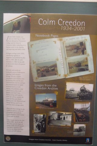
Colm Creedon b. 1934, died comparatively young in 2001. He lived on the Magazine Road, was educated at Presentation College in Cork. His father worked with the railways on Albert Road. He worked with Thompson’s bakery, McCurtain Street in an administrative capacity. He drove a Morris Minor and spent much time researching in the old Cork City Reference Library on the Grand Parade.   His real passion was the railways of West Cork. In his history of the system he recounts when the diesel railcars came in in 1954 to the closure of the system in 1961 ‘the following seven years were the happiest years of my life, with endless journeys by train with my parents and friends throughout West Cork. By now, it had developed far beyond a mere interest – I had become obsessed with the whole scene and neglected nearly everything else in my life. I naturally thought it would go on forever, so when the end came in 1961 I was shattered’.

Thw West Cork system operated out of Albert Quay in Cork and at its height covered around 170 miles. It connected most of the towns in West Cork to Cork City apart from Macroom which had a separate railway base in Capwell and a small tram line from Skibbereen to Schull. The system was taken over by the state to form part of the Great Southern Railways in 1924/5 later CIE.

Colm had a large body of Movies of the Cork Railways many taken by himself. He gave many shows to local communities of these. Presumably these are with the Local Railway Preservation Society or his friends.

His books include
The Cork, Bandon and South Coast Railway Vol 1 1849-1899 (Included below), Vol 2.
The Cork and Macroom Direct Railway 1960 out of print
G.A.A. Trains 1984
Cork City Railway Stations 1985

1986 Colm Creedon History ‘The Cork, Bandon and South Coast Railway Vol 1 1849-1899.

Local Act, 41 & 42 Victoria I, c. ccxvii HL/PO/PB/1/1878/41&42V1n269
An Act for making a Railway from the Ilen Valley Railway at Drimoleague to the Town of Bantry, all in the County of Cork; and for other purposes.. [Parliamentary Archives, House of Lords]
Date: 1878
Source: Access to Archives (A2A): not kept at The National Archives

Schull and Skibbereen Tramway HC/CL/JO/10/153/179 27 June 1887

Cork County Library have a digital display of Colm’s notebooks on the Cork and Passage Railway:

Click to access CB&PR1850-1932.pdf

Interesting Blog on West Cork Railways:

The Flying Snail

Portuguese (Aguiar) Maps Cantina Planisphere, 1492, Europe Africa

Tags


The Cone of Africa . . . Took Shape in Lisbon

By Patricia Seed | HUMANITIES, January/February 2008 | Volume 29, Number 6

Click on image to enlarge.
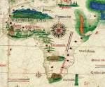
Detail of the Cantino Planisphere, showing Africa in its entirety in 1502. The world map by an anonymous Portuguese cartographer was secretly obtained by Alberto Cantino, a spy for the Duke of Ferrara, and taken to Italy. The map was recovered centuries later, hanging on the wall of a nondescript butcher shop.
Biblioteca Estense, Modena, Italy

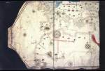
The year that Christopher Columbus crossed the Atlantic and Isabel and Ferdinand expelled the Jews from Spain, an unheralded event took place. A cartographer in Lisbon, Portugal, drew an amazing map detailing the coasts of Europe, the Mediterranean, the Black Sea, and western Africa. The map reflected an explosion of knowledge of the known world, liberating Europeans from the narrow confines of the Mediterranean and launching the era of seafaring empires. Just as Einstein’s theory of relativity changed the perception of the universe, the mapping of Africa had repercussions that would change civilization forever.

The area the Lisbon map depicts is staggering. It spans more than 10 million square miles from 5 to 55 degrees north latitude and from 27 degrees present west to 41 degrees east longitude. At the top, Edinburgh’s Firth of Forth emerges, while to the south, the Volta River appears in eastern Ghana. On the west, the map displays the Azores, volcanic islands one-third of the way across the Atlantic and, on the east, Jerusalem and the shoreline of present-day Georgia in the Caucasus Mountains.

Unlike previous rough outlines, the map marks a technical milestone with the rendering of its large coastline. Drawn entirely by hand and completed in 1492, the contours of this map are instantly identifiable. Placed atop a modern map of the same region, the level of accuracy is startling. Europe and Africa look the way they do on a contemporary map today.

This sketch is arresting in another sense. At the time, most European geographers were following the tradition from the first century C.E., drawing Portugal as a brick and North Africa as a block. But this Portuguese cartographer was sketching sinuous coastlines, undulating back and around in rococo patterns. How did the mapmakers’ usual world of straight lines, sharp angles, and the occasional perfectly symmetrical circle become transformed into these extravagantly baroque curves? And how did they come to reflect the shape of Europe and Africa so successfully?

We know almost nothing about the man who created this masterpiece; we only have his unusually formed declaration of authorship. The cartographer did not sign the map or leave an impersonal sidebar to say that so-and-so drew this. Instead, the map announces its author with the words: “Jorge de Aguiar made me in Lisbon in the year of our Lord Jesus Christ 1492.” Other Portuguese maps from this era proclaim their designer in the same fashion, announcing, “Pedro Reinel made me,” the map thus speaking for itself and its maker.

This small inscription of authorship contains all the certain knowledge we have of the mapmaker. The biggest clue comes from his surname Aguiar, a town in northern Portugal near the River Douro. Beyond that location, scholars have identified two possible sets of relatives, taking independent directions regarding his identity. The first connection links him to Portuguese voyages. Two Aguiars married into the founding families of the Portuguese colonies on Madeira and Cape Verde Islands, and two different men surnamed Aguiar commanded eastward-bound ships; one led a vessel that foundered off the coast of Africa in 1502, and the other captained a small fleet that successfully sailed to India in 1508. However, the surname Aguiar also appears frequently in lists of Sephardim—Iberian Jews who were forced by the Inquisition to convert or leave, first Spain in 1492 and then Portugal in 1497.

The tale of how an obscure Portuguese map came to encompass so much of the known world in 1492 remains a mystery. No scratches, notes, or palimpsests appear, only the map itself. Nor have any written instructions or directions for building a map been found. In the history of mapping we know astonishingly little about this most important moment—the period when mapmakers learned to make charts to scale accurately. We do know when and where the process started and finished: beginning along the African coast sometime after 1434 and ending less than sixty years later with Aguiar’s map and others. Our failure to know much more about this process stems largely from nature’s wrath.

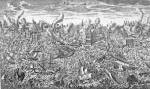
On a bright sunny, cloudless Saturday in 1755 two successive massive earthquakes devastated Lisbon. At 9:40 a.m., on the morning of November 1, the city was struck by what modern geologists have determined to have been a magnitude 8 earthquake, the same magnitude as the quake that destroyed San Francisco in 1906. But for Lisbon the trembling had only begun. Five minutes later, an earthquake perhaps as much as a hundred times stronger—over a magnitude 9—was provoked by the first. This mega thrust was similar in size to the December 26, 2004, shaking that triggered the massive and devastating tsunami in the Indian Ocean.

Lisbon would suffer the identical fate. Exactly an hour and a half after the first temblor, a wall of water more than sixty feet tall swept over the capital. Later that day, two more tsunamis battered the city, caused by the first earthquake and a powerful aftershock that followed. Estimates held that possibly half the city of Lisbon, some 100,000 people, died. Buildings of masonry and marble disappeared without a trace into the waters of the Tagus.

Hundreds of maps were stored in warehouses and government offices situated near the river; all were carried out to sea. At the same time, the records from the earliest African expeditions in the 1420s and 1430s were lodged several hundred miles south. In a singularly unfortunate trick of nature, these accounts resided in a building erected along the same fault as the one affecting Lisbon and even closer to the quake’s epicenter. In an instant, the tsunami that struck both places annihilated nearly all the geographic historical record of Europeans’ first mapping of Africa’s coast. While the country’s capital and commercial center was rebuilt, nothing remains of the palace housing the earliest accounts. The only maps that survived were copies and a handful of originals that happened to have been onboard ship, or in faraway private collections as Aguiar’s chart must have been. It is often said that history is composed by the winners; but it is equally true that history is written with the records that Mother Nature and men have spared.

The clues to Aguiar’s achievement must be found in the drawing itself. The sinuous lines wending their way across the parchment surface consist almost entirely of coastlines—with almost no details to represent the interior. These coastlines, in turn, are decorated with the names of locations placed at almost exactly right angles to the shoreline, creating the illusion of a densely inhabited coastal zone. In short, the colossal size and scale of this map is designed for sailing.

The tradition of densely filled sailing maps began two hundred years earlier, when the first such chart appeared depicting an area more than 970,000 square miles around the Mediterranean. Over the next one hundred and seventy years mapmakers gradually added to this chart, slowly marking the coasts of Europe, north to England and Ireland and usually no farther than the Low Countries on the continent. By 1492, Jorge de Aguiar and his fellow Portuguese cartographers had transformed a simple Mediterranean sea chart into a display ten times larger, accurately depicting 10 million square miles of the known world. But where his European coasts merely improved upon previous designs, his drawings of the African coasts were entirely new.

Less than sixty years before, maps of Africa depicted its Mediterranean coast and tiny slivers along the east and west. No sketch depicted the outline of Africa south of the Sahara on the west or south of the outline of the Red Sea in the east. Conjectures, however, abounded.

One group of mapmakers speculated that to the south, Africa consisted of a solid mass of land, ending somewhere near what we now know as Antarctica. Others imagined that a body of water, “the encircling ocean,” lay somewhere to the very south, again in the vicinity of present-day Antarctica. Neither was right—although beliefs in the encircling ocean came closer to reality. In truth, no one knew what lay to the south of these two edges—both factions were merely guessing.

Between 1434 and 1499 Portuguese navigators found the reality that lay beyond those two corners of the Sahara and the Red Sea; a cone-shaped continent surrounded on all sides by seas.

To sail around Africa, Portuguese pilots had to develop an entirely new repertoire of sailing techniques. In other parts of the world, sailors could safely follow regular winds, waves, weather, or the coast to reach their destinations. But at a promontory called Cabo Bojador (in Arabic Abu Khatar, meaning the “father of danger”) in what is presently western Sahara, sailors found themselves forced to sail out of sight of land.

Twelfth-century Arab geographer Al-Idrisi described this area as “the Sea of Darkness. . . . The sky is always overcast. . . . The waters of this sea are covered with cloud and dark in color. The waves are enormous, and the sea is deep. Darkness reigns continually, and navigation is difficult. The winds are violent and towards the west its limits are unknown.” Adding later, “No one knows what exists beyond this sea, no one has been able to learn anything for certain, because of the difficulty of crossing it, its profound darkness, the height of its waves, the frequency of its storms, the prevalence of its [sea] animals and the violence of its winds.”

Once at sea off Cape Bojador, ships were quickly drawn into a strong current that pulled them increasingly to the west, dragging them steadily away from the African coast and into the middle of the Atlantic. Voyaging southward down Africa’s coast required maneuvering against the winds, waves, and currents. Beginning with Gil Eanes’s rounding the promontory in 1434 (the fifteenth attempt by the Portuguese), sailors began following a counterintuitive course, moving east in order to travel south, and for the first time passing around the cape.

Starting in the 1420s, voyages initially sponsored by Prince Henry, nicknamed “The Navigator,” were launched with specific directions to collect information for maps. Maps visually recorded the distances, directions, and landmarks that previous sailors had encountered along the way, replacing the orally transmitted folk wisdom of pilots with a written record that could transmit knowledge of seas and routes expediently to a great number of individuals, allowing frequent journeys into the Atlantic and along the coast of Africa. Rumors of gold and other exotic goods in Africa’s interior were tantalizing to a kingdom that had few resources of its own—tempting enough to overcome superstition and fear of the unknown in order to get there.

Henry’s father, King John I, had recognized the importance of maps and sponsored the move to Lisbon of at least one prominent Jewish cartographer from the eastern Iberian kingdom of Valencia. In the wake of the first massacres of Jews in this region and growing anti-Semitism in the decades that followed, more Jewish cartographers fled to relative safety in Lisbon. The maps they made were held as carefully guarded state secrets, lest other European competitors beat the Portuguese to claim land and trade.

As instructed by Prince Henry, certain individuals onboard Portuguese ships made note of the natural landscape—beaches, groves of trees, dunes, and hilltops—sketching the height and shape of these features as seen from the deck of a ship. Each profile would allow explorers on subsequent expeditions to verify their locations by seeing if the contours of the land in the sketches matched up with what they could see. This practice remains a part of modern sailing.

On the voyages, outlines of bays, capes, peninsulas, islands, and river deltas would be sketched. Drawing the contours of each segment of coastline, sailors also measured the distances between these features. Each voyage would produce a new segment of the coastline. Slice by slice, trip by trip, these men accumulated the details of the coasts of Africa.

Back in Lisbon, professional mapmakers combined the information from each of these fragmentary drawings. At first the maps resembled jigsaw puzzles with separate sections of coast attached at odd angles. One small segment might be depicted in its true north-south direction while the following segment was attached at a slightly tipsy angle and the one after that tilting in an equally wrong but completely opposite direction. If you were to eliminate the bays and harbors that decorated these sketches, you would have a series of irregular zigzags—two zigs, one zag, one zig, two zags, and so on down the African coast.

But oceangoing voyagers were not likely to tolerate such irregularities for long. Sailors needed to discern the direction in which they were to travel, and they demanded to be able to identify the contours of the coasts they were following. Sailing to the northeast instead of the southwest could be costly in terms of lost time and supplies, assuming of course that the ship was not dragged out to sea, grounded on sandbars, or smashed on submerged rocks.

To construct larger maps, mapmakers stepped back from the careful detail inherent in the coastal sketches and transformed the coastline into a series of scalloped edges. These irregularly sized semicircles were no doubt intended to signal the bays and peninsulas that made up the coast of Africa, in recognition of the inherently nonlinear nature of seashores. Each of these scalloped-edged pieces was then placed end to end at the correct angle to the segment preceding it.

Each of these larger charts was constructed for a particular region. The west coast of Africa from the Strait of Gibraltar down to the westernmost tip of Africa at Cape Verde became one large segment. Another segment covered the entire Guinea coast from present-day Liberia in the west to Cameroon in the east. The third major segment stretched from Equatorial Guinea in the north to Angola in the south. One such map survives that combines the second and third segments together into a single chart from Liberia to Angola.

The next big step combined the first two segments from the Strait of Gibraltar to Cape Verde and then east along the Guinea coast. Then the original irregular shapes of the actual coastline could be restored, completing the transition back to the contours of earlier maps but without their fatal angular flaws.

What was the secret to establishing the correct direction to attach each successive segment? The key rested in the instrument Arabs had introduced into sailing the Mediterranean more than two hundred and fifty years before, the compass. Since a ship might sail in any direction, the compass occupied a complete circle, or 360 degrees with thirty-two equidistant lines radiating from the center, 11.25 degrees between each spoke.

In addition to sketching the shape of the peninsulas and bays, each drawing needed to indicate the direction of the coast, whether the coastline lay from east to west as it did along the Gulf of Guinea, or if it extended from northeast to southwest as it did along the Bulging Cape. However, because the compass relied upon magnetism to indicate direction, and magnetic north and true north did not always align, the compass sometimes misled the first coastal surveyors into believing that the coast lay one or two spokes in the wrong direction.

On the earliest charts, segments frequently appeared misaligned because the compass provided the wrong heading for a section of coastline. In order to have the segments of the African coast align properly, each segment had to have the correct bearing. Portuguese navigators soon realized the existence of magnetic variation—the difference between true north and magnetic north. Each of the segments added to the 1492 map contained the correction for local magnetic variation: otherwise each of the segments would be improperly aligned—much as they were in the charts of the 1460s and 1470s.

One piece of evidence for the early Portuguese mastery of measuring magnetic variation comes from the better known figure of 1492, Christopher Columbus. Having married into a prominent trading family on the island of Porto Santo, Columbus took part in numerous Portuguese expeditions, including one lengthy journey along the Guinea coast in the early 1480s. Later, in his journal of his trip to the West Indies, he frequently mentioned corrections he made for magnetic variation as he barreled westward into the Atlantic. Another confirmation of Portuguese expertise is in the first map of the entire African continent just after 1500, which contains a place named Cape of the Needles (Cabo das Agulhas), as a Portuguese navigator explained, because at that point, the southernmost tip of the African continent, magnetic north and true north are indistinguishable.

A decade after Columbus set foot in the New World and Jorge de Aguiar finished his map, the first single chart of Africa’s 16,000-mile coastline appeared, including nearly 10,000 miles that had been added in less than seventy years. The entire shape of the African continent emerged, the inverted cone, surrounded—as hundreds of sailors could attest—almost entirely by water.

The accomplishment remains nothing short of spectacular. After learning to draw large-scale maps of coastlines for Africa, these same Portuguese cartographers, including Pedro Reinel and his son Jorge, were some of the first to map the Americas.

Portuguese maps of this era were both method and mirror, establishing the direction and distance in which ships should travel while at the same time displaying Europe’s astounding overseas spread. Maps enabled Europeans’ increasingly far-flung forays overseas, depicting the places they had visited in pursuit of wealth. Maps constituted the crucial means by which Europeans launched seafaring empires and established a truly global economy. Crossing hundreds of miles of ocean, gold began to arrive in Europe in greater quantities than had been seen in several centuries, as did salt, ivory, and pepper.

But the seaborne trade also included humans, exported from Africa in increasing numbers across far greater distances than before, becoming slaves in Europe, the Atlantic islands, and the New World. The maps that illuminated the sea routes and ports of Africa would be used just as easily to expedite the trade in humans as they were to facilitate commerce in ivory and gold.

Patricia Seed is a professor of history at the University of California, Irvine. She is the author of Ceremonies of Possession in Europe’s Conquest of the New World, American Pentimento: The Invention of Indians and the Pursuit of Riches (winner of American Historical Association’s prize in Atlantic History), and more recently José Limón and la Malinche: The Dancer and the Dance. Seed received an NEH Digital Start-Up Grant to digitize a rare collection of Portuguese maps from 1434–1504 for general and scholarly use. View an early version of the grant’s website.
KEYWORDS:AfricaCartographyExplorationPortugalSailing
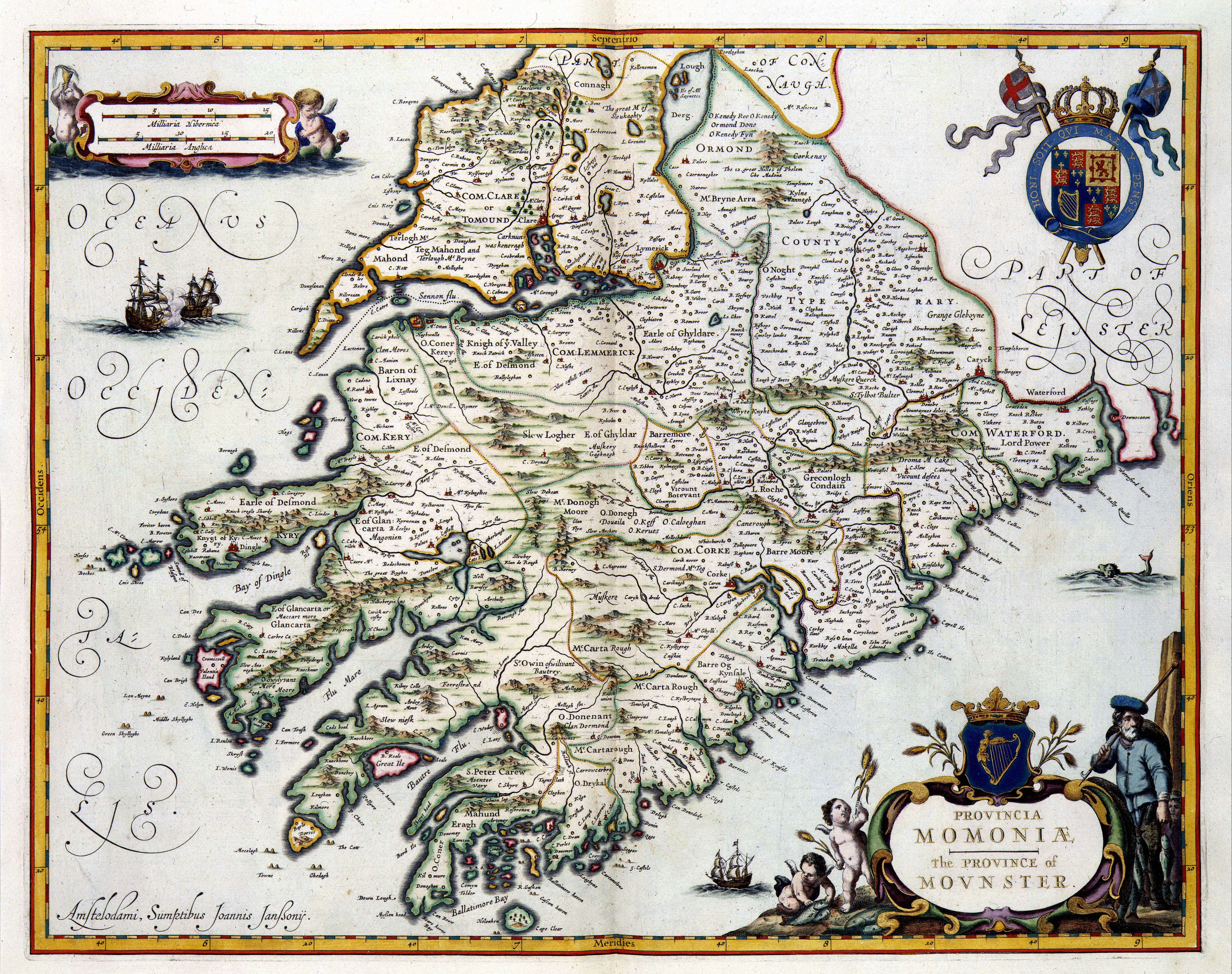
Dutch map of Munster 1646


Title: PROVINCIA MOMONIA The PROVINCE of MOVNSTER
Creator:
uitgever: Sumptibus Joannis Janssony
Keyword:
Ireland (location)
Mounster (location)
Ireland (location)
Mounster (location)
Janssonius, Johannes (person)
Blaeu, Joan (person)
Speed, John (person)
Date of creation: 1646
Object:
kaart
Source: 1049B11_053 (kopergravure, kaart ), Atlas Van der Hagen, Koninklijke Bibliotheek, Den Haag
Copyright: for information contact: Koninklijke Bibliotheek, The Hague
In 1645, Joan Blaeu (1598-1673) successfully published an atlas of Great Britain. Blaeu based this atlas on the Theatre of the Empire of Great Britaine published by his English colleague John Speed (1552-1629) in 1611. Infected by this success, Blaeus neighbour, Johannes Janssonius (1588-1664), copied the complete atlas. Janssonius published this pirate issue in 1646. This map of Mounster has been taken from Janssonius atlas.

Image

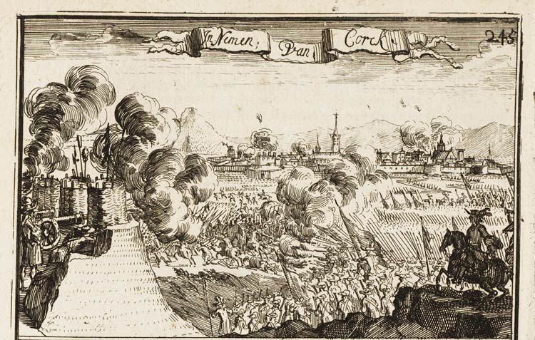
Dutch etching, Bombardment of Cork 1690.

Tags


Title: Inname van Cork en Kinsale, Ierland 1690
Creator:
uitgever: Casteleyn, Abraham (wed.)
Keyword:
Corck
veldslag
Kinsale
krijgsgeschiedenis
Ierland
Date of creation: 1691
Temporal: 1690
Object:
buitentekstillustratie
Source: 00102442C/006 (buitentekstillustratie), Het militaire leven, Nederlands Legermuseum, Delft
Copyright: for information contact: Legermuseum

Kinsale is mentioned but it looks like the bombardment of Cork from Cat Fort (off present Barrack St.)