
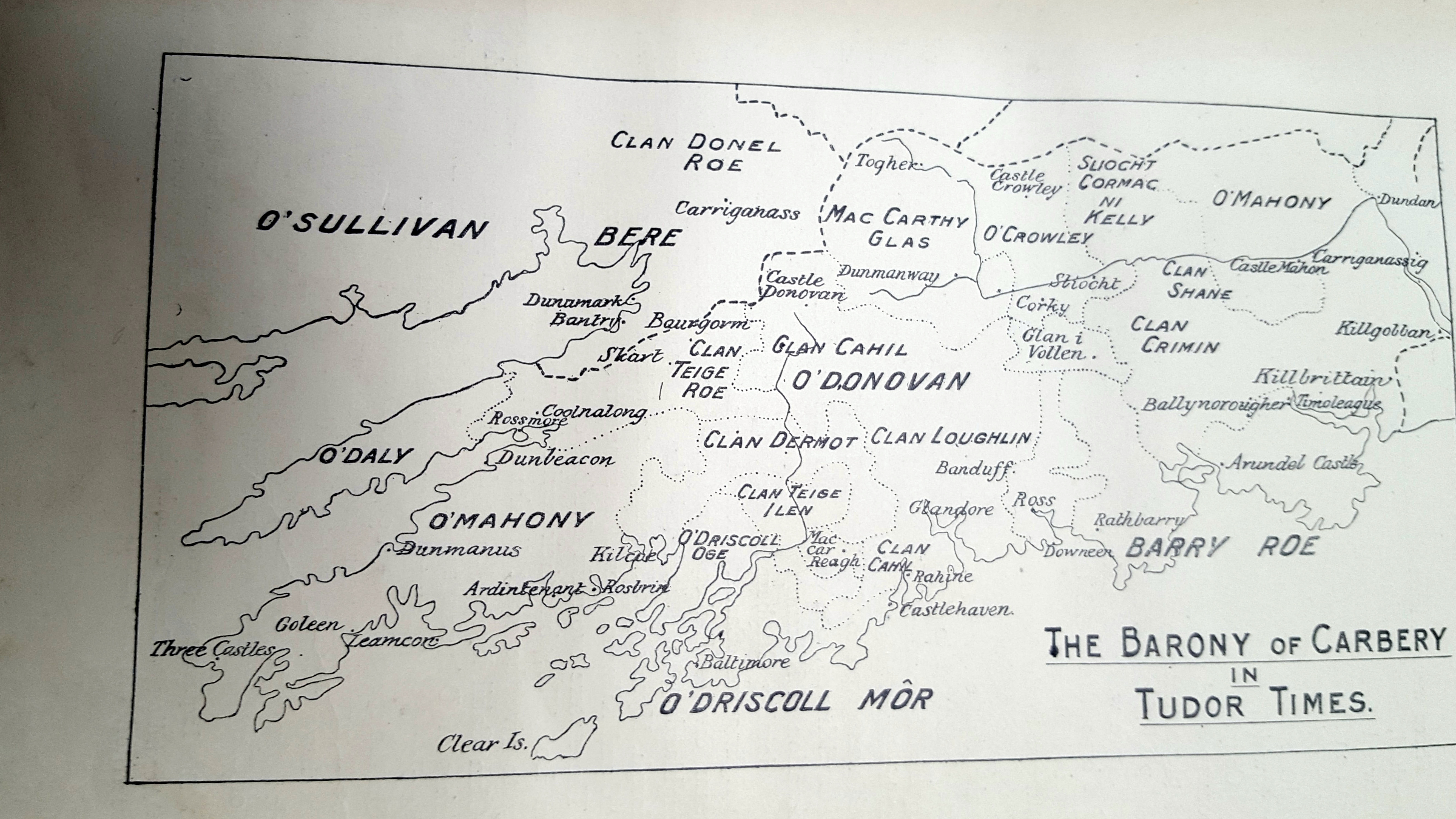
Courtesy Cork Historical and Archaeological Society 1904.
…
The families shown are strongly still represented. The influx of those who have arrived since have been absorbed. DNA evidence suggests a significant amount of intermarriage in the late 17th and 18th century so the headline surname is no guide to the multiple origins of the particular family regardless of religion. From the mid 18th to mid 19th century this was one of the most densely populated rural areas in the world, excluding lake, bog and mountain.
https://wordpress.com/block-editor/post/durrushistory.com/34230

Where is this map from, Pat?
LikeLike
Pingback: 1837. Map of West Cork and some Earlier Maps. | West Cork History
Pingback: 1750, 1774, Maps of Cork from Dr. Charles Smith’s History. | West Cork History
Reblogged this on West Cork History.
LikeLike