
Map West Cork
Thanks to Marthanne Williamson Canada, (she descends from Bakers, Rossmore, Durrus)
The credit goes to the Ulster Scots Irish Genelogy Group, USA.

1794_Rocque_Wall_Map_of_Ireland_-_Geographicus_-_Ireland2-rocque-1794.j
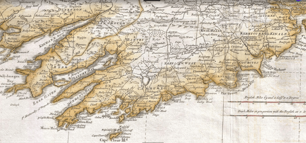
In the West Cork Map the settled area is south of the Bandod River as far as Dunmanway. The road network is fairly well devopoed comente on by Generl vallency who adi in 1760 it was fdreadfi=ul bu by 170 a good nIn the West Cork Map the settled area is south of the Bandon River as far as Dunmanway. The road network is fairly well developed comente on by General Vallency who said in 1760 it was dreadful but by 1790 a good network. Work on the main routes was largely completed by Richard Griffith by early 1830, Schull/Cookhaven, Ballydehob/Bantry, patches of Bantry/Castletownbere (even in the 1970 West Cork T.D. Paddy Sheehan referred to it as ‘The Burma Trail’, back road to Bantry from Cookstown over Cousane Gap to Bantry Bay..

I wont to know the name of the south Ireland in the Middle Ages, perhaps with relations ships whit the Basque ports. Bilbao, Plesentia. Lekeiito,
LikeLike