https://www.google.ie/maps/place/Bawnlahan,+Co.+Cork/@51.5569396,-9.1654124,15z/data=!3m1!4b1!4m2!3m1!1s0x4845ae94a6f53007:0x2600c7a7bb4cc842

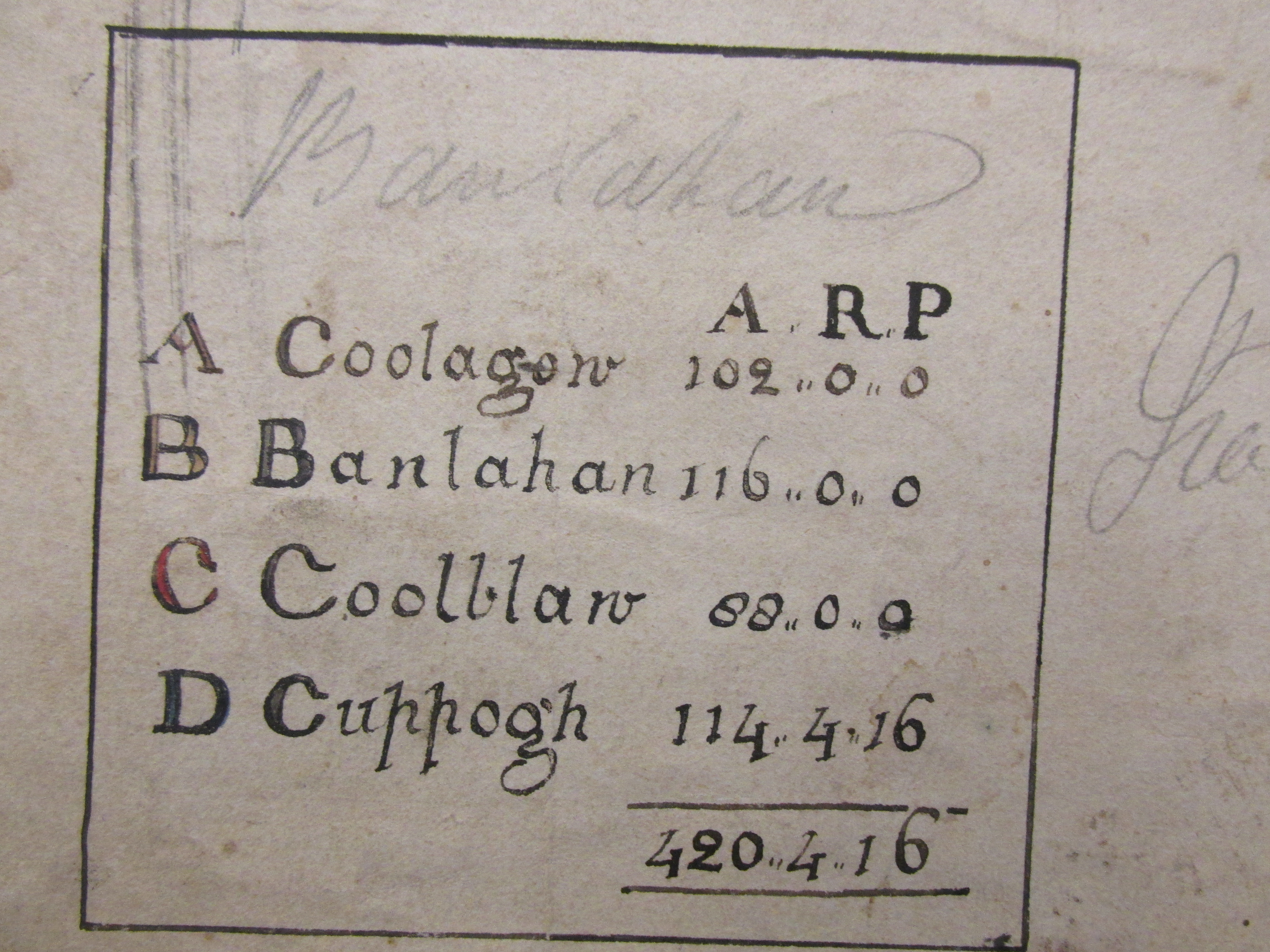
Survey 15th March 1727, of O’Donovan Estates, Bawnlahan including townlands of Coolagow, Bawnlahan and Cuppogh, West Cork.

Survey and Map by Robert J Wolfe December 1835, of Estate of Major Edward Powell (Estate of the Late Lieutenant Colonel Richard O’Donovan of the enniskillen Dragoons by his marriage with Miss Powell of Wales) at Drinagh, West Cork showing Major Tenants, Keelnacolly, Corrigfadda, Corrigagrinane, Kippagh, Knockmore, Corriglas Pike mentioned.

Survey by John Mollowny, 1st June 1769 of Estate of Daniel O’Donovan Esq., East Carbery, at Killyling, consisting of 705 acres Townlands mentioned Carran, Gorteenadooge, Knockadagh, Ballyaroo and Lagh and 1801 survey of Rectory Lislee Barony of Ibane by John Moloney.

Map of O’Donovan Estate, Bawnlahan, Skibbereen 1727, Courelickey, Drinagh, 1765, Killglinny, Schull, Corriglass, Drinagh 1832 with tenants and Bawnlahan leased by William Clerke from Madame O’Donovan 1831.

5-IMG_4736 4-IMG_4735 3-IMG_4734 2-IMG_4732 1-IMG_4733 4-IMG_4740 3-IMG_4739 2-IMG_4738 1-IMG_4737